Lewolaga geodata
Lewolaga (East Nusa Tenggara) is a seat of a third-order administrative division; located in Indonesia in Asia/Makassar (GMT+8) time zone. In our database, there are 407 cities with bigger population. Compared to other cities in Indonesia, 80.8% of cities are located further ↑North; 89.4% of cities are located further ←West and 80.9% of cities have higher elevation than Lewolaga. Note1


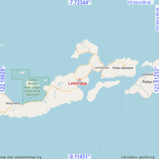
Lewolaga GPS coordinates[2]
8° 25' 10.56" South, 122° 48' 33.84" East
| Map corner | latitude | longitude |
|---|---|---|
| Upper-left | -7.72344°, | 122.10628° |
| Center: | -8.4196°, | 122.8094° |
| Lower-right: | -9.11451°, | 123.51253° |
| Map W x H: | 154.7×154.7 km | = 96.1×96.1mi |
| max Lat: | 5.88969° ⇑80.8% North |
| Lewolaga: | -8.4196° |
| min Lat: | ⇓19.2% South -10.934° |
| min Long | Lewolaga | max Long |
| 95.1345° | 122.8094° | 140.9419° |
| W 89.4%⇐ | ⇒10.6% E |
Elevation
Elevation of Lewolaga is 18 m = 59 ft, and this is 211.7 m = 695 ft below average elevation for this country.
| Max E: |
3185 m = 10449 ft | 80.9% |
| Avg. | 229.7 m = 754 ft | |
| Lewolaga | 18 m = 59 ft | |
Min E: |
-1 m = -3 ft | 19.1% |
See also: Indonesia elevation on elevation.city.
Geographical zone
Lewolaga is located in South Torrid zone (between Equator and Tropic of Capricorn). Distance of Equator is 936.2 km =581.7 mi to North.| Distance of | km | miles | from Lewolaga |
|---|---|---|---|
| Equator | 936.2 | 581.7 | to North |
| Tropic Capricorn | 1669.7 | 1037.5 | to South |
| Antarctic Circle | 6465 | 4017.2 | to South |
| South Pole | 9070.9 | 5636.4 | to South |


Nearby cities:
15 places around Lewolaga: (largest is in red/bold)
• Bama
9.2 km =5.7 mi,  58°
58°
• Blaloudeng
3.2 km =2 mi,  315°
315°
• Buri
3.2 km =2 mi,  7°
7°
• Eputobi
2.8 km =1.7 mi,  65°
65°
• Gerong
2.7 km =1.7 mi,  295°
295°
• Kanada
4.7 km =2.9 mi,  255°
255°
• Konga
5.1 km =3.2 mi,  226°
226°
• Lamika
3.6 km =2.2 mi,  84°
84°
• Lato
8 km =5 mi, 315°
• Lewokluok
5.3 km =3.3 mi, 59°
• Lewoluo
11.6 km =7.2 mi,  349°
349°
• Leworook
4.1 km =2.5 mi,  28°
28°
• Nobo
7.6 km =4.7 mi,  196°
196°
• Nurabelen
11 km =6.8 mi,  170°
170°
• Wolo
5.2 km =3.2 mi, 71°
Sources, notices
• [Note1] Compared only with cities in Indonesia existing in our database
• [Src1] Map data: © OpenStreetMap contributors (CC-BY-SA)
• [Src2] Other city data from geonames.org with taken over terms of usage.
• [Src3] Geographical zone / Annual Mean Temperature by Robert A. Rohde @ Wikipedia
