Pomasule geodata
Pomasule (East Nusa Tenggara) is a seat of a fourth-order administrative division; located in Indonesia in Asia/Makassar (GMT+8) time zone. In our database, there are 407 cities with bigger population. Compared to other cities in Indonesia, 92.5% of cities are located further ↑North; 85.3% of cities are located further ←West and 64.5% of cities have higher elevation than Pomasule. Note1


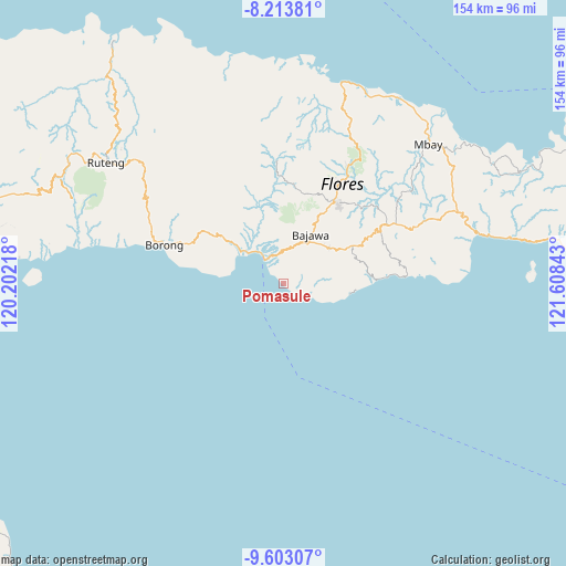
Pomasule GPS coordinates[2]
8° 54' 32.76" South, 120° 54' 19.08" East
| Map corner | latitude | longitude |
|---|---|---|
| Upper-left | -8.21381°, | 120.20218° |
| Center: | -8.9091°, | 120.9053° |
| Lower-right: | -9.60307°, | 121.60843° |
| Map W x H: | 154.5×154.5 km | = 96×96mi |
| max Lat: | 5.88969° ⇑92.5% North |
| Pomasule: | -8.9091° |
| min Lat: | ⇓7.5% South -10.934° |
| min Long | Pomasule | max Long |
| 95.1345° | 120.9053° | 140.9419° |
| W 85.3%⇐ | ⇒14.7% E |
Elevation
Elevation of Pomasule is 44 m = 144 ft, and this is 185.7 m = 609 ft below average elevation for this country.
| Max E: |
3185 m = 10449 ft | 64.5% |
| Avg. | 229.7 m = 754 ft | |
| Pomasule | 44 m = 144 ft | |
Min E: |
-1 m = -3 ft | 35.5% |
See also: Indonesia elevation on elevation.city.
Geographical zone
Pomasule is located in South Torrid zone (between Equator and Tropic of Capricorn). Distance of Equator is 990.6 km =615.5 mi to North.| Distance of | km | miles | from Pomasule |
|---|---|---|---|
| Equator | 990.6 | 615.5 | to North |
| Tropic Capricorn | 1615.3 | 1003.7 | to South |
| Antarctic Circle | 6410.6 | 3983.4 | to South |
| South Pole | 9016.5 | 5602.6 | to South |


Nearby cities:
15 places around Pomasule: (largest is in red/bold)
• Aimere
9 km =5.6 mi,  324°
324°
• Bojawa
10.2 km =6.3 mi,  35°
35°
• Bosiko
14.5 km =9 mi, 40°
• Dona
13.3 km =8.3 mi,  86°
86°
• Gurusina
9.5 km =5.9 mi,  81°
81°
• Malabhaga
11.4 km =7.1 mi, 75°
• Malapedo B
1.4 km =0.9 mi,  137°
137°
• Mari
11 km =6.8 mi,  34°
34°
• Nuamuzi
13.1 km =8.1 mi,  63°
63°
• Paukate
12.1 km =7.5 mi,  332°
332°
• Ruto
2.9 km =1.8 mi,  129°
129°
• Rutojawa
12 km =7.5 mi, 92°
• Waebela
8.3 km =5.2 mi,  116°
116°
• Waelengga
14.2 km =8.8 mi,  310°
310°
• Warekeo
13.6 km =8.5 mi, 58°
Sources, notices
• [Note1] Compared only with cities in Indonesia existing in our database
• [Src1] Map data: © OpenStreetMap contributors (CC-BY-SA)
• [Src2] Other city data from geonames.org with taken over terms of usage.
• [Src3] Geographical zone / Annual Mean Temperature by Robert A. Rohde @ Wikipedia
