Nila Dua geodata
Nila Dua (East Nusa Tenggara) is a seat of a fourth-order administrative division; located in Indonesia in Asia/Makassar (GMT+8) time zone. In our database, there are 407 cities with bigger population. Compared to other cities in Indonesia, 83.8% of cities are located further ↑North; 86.3% of cities are located further ←West and 79.9% of cities have higher elevation than Nila Dua. Note1


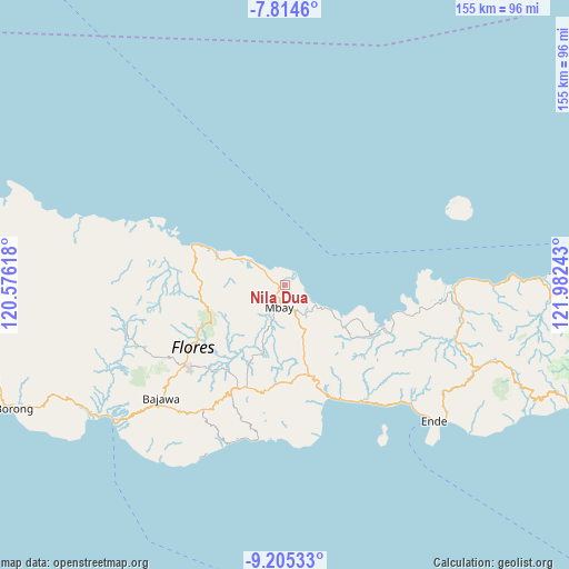
Nila Dua GPS coordinates[2]
8° 30' 38.16" South, 121° 16' 45.48" East
| Map corner | latitude | longitude |
|---|---|---|
| Upper-left | -7.8146°, | 120.57618° |
| Center: | -8.5106°, | 121.2793° |
| Lower-right: | -9.20533°, | 121.98243° |
| Map W x H: | 154.6×154.6 km | = 96.1×96.1mi |
| max Lat: | 5.88969° ⇑83.8% North |
| Nila Dua: | -8.5106° |
| min Lat: | ⇓16.2% South -10.934° |
| min Long | Nila Dua | max Long |
| 95.1345° | 121.2793° | 140.9419° |
| W 86.3%⇐ | ⇒13.7% E |
Elevation
Elevation of Nila Dua is 19 m = 62 ft, and this is 210.7 m = 691 ft below average elevation for this country.
| Max E: |
3185 m = 10449 ft | 79.9% |
| Avg. | 229.7 m = 754 ft | |
| Nila Dua | 19 m = 62 ft | |
Min E: |
-1 m = -3 ft | 20.1% |
See also: Indonesia elevation on elevation.city.
Geographical zone
Nila Dua is located in South Torrid zone (between Equator and Tropic of Capricorn). Distance of Equator is 946.3 km =588 mi to North.| Distance of | km | miles | from Nila Dua |
|---|---|---|---|
| Equator | 946.3 | 588 | to North |
| Tropic Capricorn | 1659.6 | 1031.2 | to South |
| Antarctic Circle | 6454.9 | 4010.9 | to South |
| South Pole | 9060.8 | 5630.1 | to South |


Nearby cities:
15 places around Nila Dua: (largest is in red/bold)
• Baobe
9.4 km =5.8 mi,  212°
212°
• Boanio
14.9 km =9.3 mi,  161°
161°
• Doma
20.1 km =12.5 mi, 164°
• Gero
23.7 km =14.7 mi, 205°
• Jawakisa
17.7 km =11 mi,  200°
200°
• Jawatiwa
21.9 km =13.6 mi,  179°
179°
• Malabai
15.1 km =9.4 mi,  248°
248°
• Malapaubhara
22.8 km =14.2 mi,  228°
228°
• Malawona
12.6 km =7.8 mi, 204°
• Mbay
5.7 km =3.5 mi,  188°
188°
• Nanganumba
7.7 km =4.8 mi,  306°
306°
• Tungguwaneng
17.3 km =10.7 mi,  294°
294°
• Uluwolo
7.3 km =4.5 mi,  170°
170°
• Watuapi
19.2 km =11.9 mi,  126°
126°
• Wewoloe
3.2 km =2 mi,  222°
222°
Sources, notices
• [Note1] Compared only with cities in Indonesia existing in our database
• [Src1] Map data: © OpenStreetMap contributors (CC-BY-SA)
• [Src2] Other city data from geonames.org with taken over terms of usage.
• [Src3] Geographical zone / Annual Mean Temperature by Robert A. Rohde @ Wikipedia
