Golokutu geodata
Golokutu (East Nusa Tenggara) is a seat of a fourth-order administrative division; located in Indonesia in Asia/Makassar (GMT+8) time zone. In our database, there are 407 cities with bigger population. Compared to other cities in Indonesia, 81% of cities are located further ↑North; 85.7% of cities are located further ←West and 68% of cities have higher elevation than Golokutu. Note1


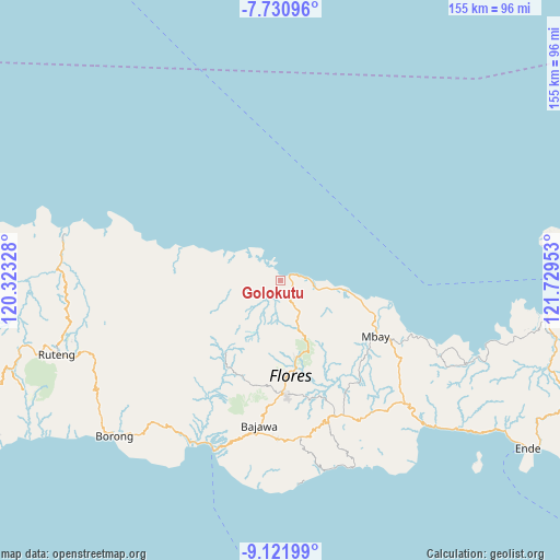
Golokutu GPS coordinates[2]
8° 25' 37.56" South, 121° 1' 35.04" East
| Map corner | latitude | longitude |
|---|---|---|
| Upper-left | -7.73096°, | 120.32328° |
| Center: | -8.4271°, | 121.0264° |
| Lower-right: | -9.12199°, | 121.72953° |
| Map W x H: | 154.7×154.7 km | = 96.1×96.1mi |
| max Lat: | 5.88969° ⇑81% North |
| Golokutu: | -8.4271° |
| min Lat: | ⇓19% South -10.934° |
| min Long | Golokutu | max Long |
| 95.1345° | 121.0264° | 140.9419° |
| W 85.7%⇐ | ⇒14.3% E |
Elevation
Elevation of Golokutu is 36 m = 118 ft, and this is 193.7 m = 635 ft below average elevation for this country.
| Max E: |
3185 m = 10449 ft | 68% |
| Avg. | 229.7 m = 754 ft | |
| Golokutu | 36 m = 118 ft | |
Min E: |
-1 m = -3 ft | 32% |
See also: Indonesia elevation on elevation.city.
Geographical zone
Golokutu is located in South Torrid zone (between Equator and Tropic of Capricorn). Distance of Equator is 937 km =582.2 mi to North.| Distance of | km | miles | from Golokutu |
|---|---|---|---|
| Equator | 937 | 582.2 | to North |
| Tropic Capricorn | 1668.9 | 1037 | to South |
| Antarctic Circle | 6464.2 | 4016.7 | to South |
| South Pole | 9070.1 | 5635.9 | to South |


Nearby cities:
15 places around Golokutu: (largest is in red/bold)
• Baobe
28.6 km =17.8 mi,  127°
127°
• Kembo
16.4 km =10.2 mi,  281°
281°
• Lengkorandang
28.1 km =17.5 mi,  288°
288°
• Malabai
20.2 km =12.6 mi,  137°
137°
• Malapaubhara
26.7 km =16.6 mi,  156°
156°
• Marolidhong
5.8 km =3.6 mi,  175°
175°
• Mbarungkeli
4.1 km =2.5 mi,  306°
306°
• Nanganumba
22.1 km =13.7 mi,  102°
102°
• Nila Dua
29.3 km =18.2 mi,  108°
108°
• Punsu
0.9 km =0.6 mi,  356°
356°
• Riung
0.7 km =0.4 mi,  352°
352°
• Tungguwaneng
12.3 km =7.6 mi, 100°
• Waepana
29.5 km =18.3 mi, 177°
• Wate
10.8 km =6.7 mi,  222°
222°
• Wewoloe
28.2 km =17.5 mi, 114°
Sources, notices
• [Note1] Compared only with cities in Indonesia existing in our database
• [Src1] Map data: © OpenStreetMap contributors (CC-BY-SA)
• [Src2] Other city data from geonames.org with taken over terms of usage.
• [Src3] Geographical zone / Annual Mean Temperature by Robert A. Rohde @ Wikipedia
