Campraksanta geodata
Campraksanta (Banten) is a seat of a fourth-order administrative division; located in Indonesia in Asia/Jakarta (GMT+7) time zone. In our database, there are 407 cities with bigger population. Compared to other cities in Indonesia, 86.8% of cities are located further ↓South; 89.9% of cities are located further →East and 82.7% of cities have lower elevation than Campraksanta. Note1


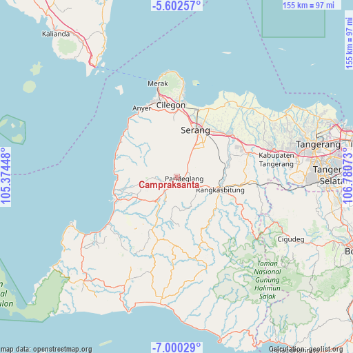
Campraksanta GPS coordinates[2]
6° 18' 6.84" South, 106° 4' 39.36" East
| Map corner | latitude | longitude |
|---|---|---|
| Upper-left | -5.60257°, | 105.37448° |
| Center: | -6.3019°, | 106.0776° |
| Lower-right: | -7.00029°, | 106.78073° |
| Map W x H: | 155.4×155.4 km | = 96.6×96.6mi |
| max Lat: | 5.88969° ⇑13.2% North |
| Campraksanta: | -6.3019° |
| min Lat: | ⇓86.8% South -10.934° |
| min Long | Campraksanta | max Long |
| 95.1345° | 106.0776° | 140.9419° |
| W 10.1%⇐ | ⇒89.9% E |
Elevation
Elevation of Campraksanta is 475 m = 1558 ft, and this is 245.3 m = 805 ft above average elevation for this country.
| Max E: |
3185 m = 10449 ft | 17.3% |
| Campraksanta | 475 m 1558 ft | |
| Avg. | 229.7 m = 754 ft | |
Min E: |
-1 m = -3 ft | 82.7% |
See also: Indonesia elevation on elevation.city.
Geographical zone
Campraksanta is located in South Torrid zone (between Equator and Tropic of Capricorn). Distance of Equator is 700.7 km =435.4 mi to North.| Distance of | km | miles | from Campraksanta |
|---|---|---|---|
| Equator | 700.7 | 435.4 | to North |
| Tropic Capricorn | 1905.2 | 1183.8 | to South |
| Antarctic Circle | 6700.5 | 4163.5 | to South |
| South Pole | 9306.4 | 5782.7 | to South |


Nearby cities:
15 places around Campraksanta: (largest is in red/bold)
• Cibebek
4.4 km =2.7 mi,  181°
181°
• Cidahu
2.5 km =1.6 mi,  245°
245°
• Ciekek
3.2 km =2 mi,  130°
130°
• Cilaja
1.9 km =1.2 mi, 129°
• Cipacung Landeuh
3.1 km =1.9 mi,  169°
169°
• Gardutanjak
2.9 km =1.8 mi,  115°
115°
• Girihieum
3.5 km =2.2 mi,  195°
195°
• Juhut
3.3 km =2.1 mi,  77°
77°
• Kabayancitiis
3.7 km =2.3 mi,  107°
107°
• Keboncau
3.1 km =1.9 mi,  100°
100°
• Majamasjid
3.4 km =2.1 mi,  150°
150°
• Pandeglang
3.3 km =2.1 mi, 102°
• Penikebon
4.6 km =2.9 mi, 166°
• Rokoy
3.9 km =2.4 mi,  208°
208°
• Tanagara
4.5 km =2.8 mi,  25°
25°
Sources, notices
• [Note1] Compared only with cities in Indonesia existing in our database
• [Src1] Map data: © OpenStreetMap contributors (CC-BY-SA)
• [Src2] Other city data from geonames.org with taken over terms of usage.
• [Src3] Geographical zone / Annual Mean Temperature by Robert A. Rohde @ Wikipedia
