Gegernoong geodata
Gegernoong (West Java) is a seat of a fourth-order administrative division; located in Indonesia in Asia/Jakarta (GMT+7) time zone. In our database, there are 407 cities with bigger population. Compared to other cities in Indonesia, 52.8% of cities are located further ↑North; 75.7% of cities are located further →East and 76.1% of cities have lower elevation than Gegernoong. Note1


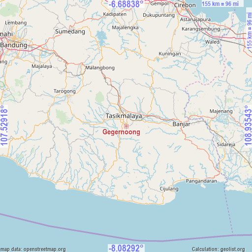
Gegernoong GPS coordinates[2]
7° 23' 10.32" South, 108° 13' 56.28" East
| Map corner | latitude | longitude |
|---|---|---|
| Upper-left | -6.68838°, | 107.52918° |
| Center: | -7.3862°, | 108.2323° |
| Lower-right: | -8.08292°, | 108.93543° |
| Map W x H: | 155.1×155.1 km | = 96.4×96.4mi |
| max Lat: | 5.88969° ⇑52.8% North |
| Gegernoong: | -7.3862° |
| min Lat: | ⇓47.2% South -10.934° |
| min Long | Gegernoong | max Long |
| 95.1345° | 108.2323° | 140.9419° |
| W 24.3%⇐ | ⇒75.7% E |
Elevation
Elevation of Gegernoong is 374 m = 1227 ft, and this is 144.3 m = 473 ft above average elevation for this country.
| Max E: |
3185 m = 10449 ft | 23.9% |
| Gegernoong | 374 m 1227 ft | |
| Avg. | 229.7 m = 754 ft | |
Min E: |
-1 m = -3 ft | 76.1% |
See also: Indonesia elevation on elevation.city.
Geographical zone
Gegernoong is located in South Torrid zone (between Equator and Tropic of Capricorn). Distance of Equator is 821.3 km =510.3 mi to North.| Distance of | km | miles | from Gegernoong |
|---|---|---|---|
| Equator | 821.3 | 510.3 | to North |
| Tropic Capricorn | 1784.7 | 1109 | to South |
| Antarctic Circle | 6579.9 | 4088.6 | to South |
| South Pole | 9185.8 | 5707.8 | to South |


Nearby cities:
15 places around Gegernoong: (largest is in red/bold)
• Awilega
2.6 km =1.6 mi,  254°
254°
• Bandung
3.5 km =2.2 mi,  114°
114°
• Bantargedang
3.6 km =2.2 mi,  32°
32°
• Cianjur Kidul
1.7 km =1.1 mi, 251°
• Cibeureum
0.3 km =0.2 mi, 109°
• Gunungmuncang
4 km =2.5 mi,  9°
9°
• Gunungsubang
4.4 km =2.7 mi,  291°
291°
• Jatiwangi
3 km =1.9 mi,  73°
73°
• Kadupandak
2.7 km =1.7 mi,  54°
54°
• Kawalu
2.7 km =1.7 mi,  280°
280°
• Nyemplong
3.9 km =2.4 mi,  154°
154°
• Pasanggrahan
3.1 km =1.9 mi,  267°
267°
• Rahayu Dua
1.6 km =1 mi, 10°
• Sengkol
2.7 km =1.7 mi,  309°
309°
• Sukamaju
1.8 km =1.1 mi,  342°
342°
Sources, notices
• [Note1] Compared only with cities in Indonesia existing in our database
• [Src1] Map data: © OpenStreetMap contributors (CC-BY-SA)
• [Src2] Other city data from geonames.org with taken over terms of usage.
• [Src3] Geographical zone / Annual Mean Temperature by Robert A. Rohde @ Wikipedia
