Bandung geodata
Bandung (West Java) is a seat of a fourth-order administrative division; located in Indonesia in Asia/Jakarta (GMT+7) time zone. In our database, there are 407 cities with bigger population. Compared to other cities in Indonesia, 53.2% of cities are located further ↑North; 75.3% of cities are located further →East and 77.2% of cities have lower elevation than Bandung. Note1


Bandung GPS coordinates[2]
7° 23' 57.48" South, 108° 15' 38.52" East
| Map corner | latitude | longitude |
|---|---|---|
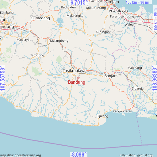
| Upper-left | -6.7015°, | 107.55758° |
| Center: | -7.3993°, | 108.2607° |
| Lower-right: | -8.096°, | 108.96383° |
| Map W x H: | 155.1×155.1 km | = 96.4×96.4mi |
| max Lat: | 5.88969° ⇑53.2% North |
| Bandung: | -7.3993° |
| min Lat: | ⇓46.8% South -10.934° |
| min Long | Bandung | max Long |
| 95.1345° | 108.2607° | 140.9419° |
| W 24.7%⇐ | ⇒75.3% E |
Elevation
Elevation of Bandung is 387 m = 1270 ft, and this is 157.3 m = 516 ft above average elevation for this country.
| Max E: |
3185 m = 10449 ft | 22.8% |
| Bandung | 387 m 1270 ft | |
| Avg. | 229.7 m = 754 ft | |
Min E: |
-1 m = -3 ft | 77.2% |
See also: Indonesia elevation on elevation.city.
Geographical zone
Bandung is located in South Torrid zone (between Equator and Tropic of Capricorn). Distance of Equator is 822.7 km =511.2 mi to North.| Distance of | km | miles | from Bandung |
|---|---|---|---|
| Equator | 822.7 | 511.2 | to North |
| Tropic Capricorn | 1783.2 | 1108 | to South |
| Antarctic Circle | 6578.4 | 4087.6 | to South |
| South Pole | 9184.3 | 5706.9 | to South |


Nearby cities:
15 places around Bandung: (largest is in red/bold)
• Bantargedang
4.7 km =2.9 mi,  344°
344°
• Cianjur Kidul
4.8 km =3 mi,  280°
280°
• Cibangun Tengah
4.5 km =2.8 mi,  6°
6°
• Cibeureum
3.2 km =2 mi,  295°
295°
• Cinunjang
3.4 km =2.1 mi,  133°
133°
• Dusundesa
2.7 km =1.7 mi,  103°
103°
• Gegernoong
3.5 km =2.2 mi,  294°
294°
• Gunajaya
3.5 km =2.2 mi,  29°
29°
• Jatiwangi
2.3 km =1.4 mi,  352°
352°
• Kadupandak
3.2 km =2 mi, 343°
• Lengkong
3.1 km =1.9 mi,  81°
81°
• Nyemplong
2.5 km =1.6 mi,  215°
215°
• Rahayu Dua
4.1 km =2.5 mi,  316°
316°
• Sukamulya
3.8 km =2.4 mi,  51°
51°
• Sukasirna
4.2 km =2.6 mi, 26°
Sources, notices
• [Note1] Compared only with cities in Indonesia existing in our database
• [Src1] Map data: © OpenStreetMap contributors (CC-BY-SA)
• [Src2] Other city data from geonames.org with taken over terms of usage.
• [Src3] Geographical zone / Annual Mean Temperature by Robert A. Rohde @ Wikipedia
