Tebing geodata
Tebing (Riau Islands) is a seat of a third-order administrative division; located in Indonesia in Asia/Jakarta (GMT+7) time zone. In our database, there are 407 cities with bigger population. Compared to other cities in Indonesia, 96.2% of cities are located further ↓South; 95.5% of cities are located further →East and 76.2% of cities have higher elevation than Tebing. Note1


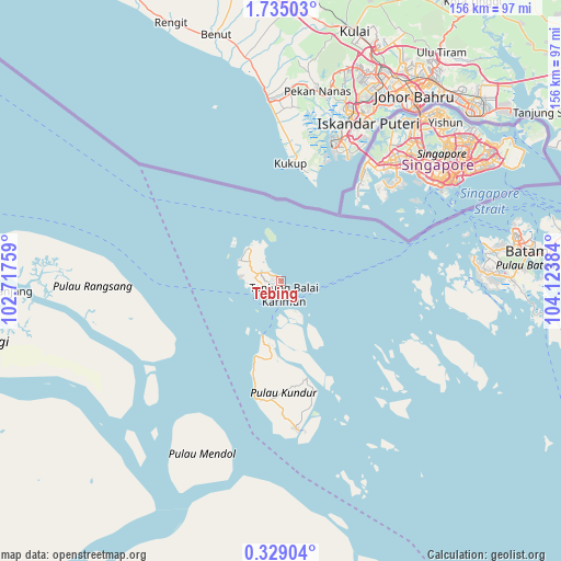
Tebing GPS coordinates[2]
1° 1' 55.596" North, 103° 25' 14.556" East
| Map corner | latitude | longitude |
|---|---|---|
| Upper-left | 1.73503°, | 102.71759° |
| Center: | 1.03211°, | 103.42071° |
| Lower-right: | 0.32904°, | 104.12384° |
| Map W x H: | 156.3×156.3 km | = 97.1×97.1mi |
| max Lat: | 5.88969° ⇑3.8% North |
| Tebing: | 1.03211° |
| min Lat: | ⇓96.2% South -10.934° |
| min Long | Tebing | max Long |
| 95.1345° | 103.42071° | 140.9419° |
| W 4.5%⇐ | ⇒95.5% E |
Elevation
Elevation of Tebing is 23 m = 75 ft, and this is 206.7 m = 678 ft below average elevation for this country.
| Max E: |
3185 m = 10449 ft | 76.2% |
| Avg. | 229.7 m = 754 ft | |
| Tebing | 23 m = 75 ft | |
Min E: |
-1 m = -3 ft | 23.8% |
See also: Indonesia elevation on elevation.city.
Geographical zone
Tebing is located in North Torrid zone (between Equator and Tropic of Cancer). Distance of Equator is 114.8 km =71.3 mi to South.| Distance of | km | miles | from Tebing |
|---|---|---|---|
| North Pole | 9892.3 | 6146.8 | to North |
| Arctic Circle | 7286.4 | 4527.6 | to North |
| Tropic Cancer | 2491.2 | 1548 | to North |
| Equator | 114.8 | 71.3 | to South |


Nearby cities:
15 places around Tebing: (largest is in red/bold)
• Bandar Seri Bentan
117.8 km =73.2 mi,  88°
88°
• Batam
68.4 km =42.5 mi,  79°
79°
• Belakangpadang
54 km =33.6 mi, 75°
• Khairiahmandah
112.7 km =70 mi,  175°
175°
• Meral
5.1 km =3.2 mi,  215°
215°
• Moro
44.5 km =27.7 mi,  134°
134°
• Pancur Biru Lestari II
70.6 km =43.9 mi, 90°
• Pasirpanjang
13.1 km =8.1 mi,  323°
323°
• Sawang
33.6 km =20.9 mi,  192°
192°
• Sekupang
57.2 km =35.5 mi, 79°
• Selat Panjang
79.3 km =49.3 mi,  266°
266°
• Tanjung Pinang
116.1 km =72.1 mi,  96°
96°
• Tanjungbatu
41.7 km =25.9 mi,  173°
173°
• Telukdalam
58.1 km =36.1 mi,  197°
197°
• Urung
28.4 km =17.6 mi, 165°
Sources, notices
• [Note1] Compared only with cities in Indonesia existing in our database
• [Src1] Map data: © OpenStreetMap contributors (CC-BY-SA)
• [Src2] Other city data from geonames.org with taken over terms of usage.
• [Src3] Geographical zone / Annual Mean Temperature by Robert A. Rohde @ Wikipedia
