Dolulolong geodata
Dolulolong (East Nusa Tenggara) is a seat of a fourth-order administrative division; located in Indonesia in Asia/Makassar (GMT+8) time zone. In our database, there are 407 cities with bigger population. Compared to other cities in Indonesia, 72.3% of cities are located further ↑North; 93.5% of cities are located further ←West and 73.4% of cities have higher elevation than Dolulolong. Note1


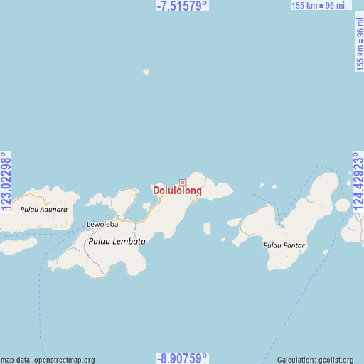
Dolulolong GPS coordinates[2]
8° 12' 44.28" South, 123° 43' 33.96" East
| Map corner | latitude | longitude |
|---|---|---|
| Upper-left | -7.51579°, | 123.02298° |
| Center: | -8.2123°, | 123.7261° |
| Lower-right: | -8.90759°, | 124.42923° |
| Map W x H: | 154.8×154.8 km | = 96.2×96.2mi |
| max Lat: | 5.88969° ⇑72.3% North |
| Dolulolong: | -8.2123° |
| min Lat: | ⇓27.7% South -10.934° |
| min Long | Dolulolong | max Long |
| 95.1345° | 123.7261° | 140.9419° |
| W 93.5%⇐ | ⇒6.5% E |
Elevation
Elevation of Dolulolong is 27 m = 89 ft, and this is 202.7 m = 665 ft below average elevation for this country.
| Max E: |
3185 m = 10449 ft | 73.4% |
| Avg. | 229.7 m = 754 ft | |
| Dolulolong | 27 m = 89 ft | |
Min E: |
-1 m = -3 ft | 26.6% |
See also: Indonesia elevation on elevation.city.
Geographical zone
Dolulolong is located in South Torrid zone (between Equator and Tropic of Capricorn). Distance of Equator is 913.1 km =567.4 mi to North.| Distance of | km | miles | from Dolulolong |
|---|---|---|---|
| Equator | 913.1 | 567.4 | to North |
| Tropic Capricorn | 1692.8 | 1051.9 | to South |
| Antarctic Circle | 6488.1 | 4031.5 | to South |
| South Pole | 9093.9 | 5650.7 | to South |


Nearby cities:
15 places around Dolulolong: (largest is in red/bold)
• Atarodangkedang
2.5 km =1.6 mi,  55°
55°
• Atarodangwautu
4.8 km =3 mi,  48°
48°
• Balauring
3.2 km =2 mi,  223°
223°
• Bareng
6.9 km =4.3 mi, 50°
• Bungalaleng
3.7 km =2.3 mi, 52°
• Hadingrobi
7.3 km =4.5 mi,  114°
114°
• Hoelea
1.7 km =1.1 mi,  102°
102°
• Leubatang
5.3 km =3.3 mi,  138°
138°
• Leuwayang
3 km =1.9 mi, 55°
• Leuweheq
2.5 km =1.6 mi, 136°
• Meluwiting
3.9 km =2.4 mi,  145°
145°
• Orolaleng
5.7 km =3.5 mi,  130°
130°
• Peuara
4.5 km =2.8 mi, 143°
• Riangbao
6.9 km =4.3 mi,  120°
120°
• Werangrae
5.5 km =3.4 mi, 48°
Sources, notices
• [Note1] Compared only with cities in Indonesia existing in our database
• [Src1] Map data: © OpenStreetMap contributors (CC-BY-SA)
• [Src2] Other city data from geonames.org with taken over terms of usage.
• [Src3] Geographical zone / Annual Mean Temperature by Robert A. Rohde @ Wikipedia
