Waiwejak geodata
Waiwejak (East Nusa Tenggara) is a seat of a fourth-order administrative division; located in Indonesia in Asia/Makassar (GMT+8) time zone. In our database, there are 407 cities with bigger population. Compared to other cities in Indonesia, 83.4% of cities are located further ↑North; 92.5% of cities are located further ←West and 86.7% of cities have lower elevation than Waiwejak. Note1


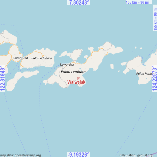
Waiwejak GPS coordinates[2]
8° 29' 54.6" South, 123° 31' 21.36" East
| Map corner | latitude | longitude |
|---|---|---|
| Upper-left | -7.80248°, | 122.81948° |
| Center: | -8.4985°, | 123.5226° |
| Lower-right: | -9.19326°, | 124.22573° |
| Map W x H: | 154.6×154.6 km | = 96.1×96.1mi |
| max Lat: | 5.88969° ⇑83.4% North |
| Waiwejak: | -8.4985° |
| min Lat: | ⇓16.6% South -10.934° |
| min Long | Waiwejak | max Long |
| 95.1345° | 123.5226° | 140.9419° |
| W 92.5%⇐ | ⇒7.5% E |
Elevation
Elevation of Waiwejak is 551 m = 1808 ft, and this is 321.3 m = 1054 ft above average elevation for this country.
| Max E: |
3185 m = 10449 ft | 13.3% |
| Waiwejak | 551 m 1808 ft | |
| Avg. | 229.7 m = 754 ft | |
Min E: |
-1 m = -3 ft | 86.7% |
See also: Indonesia elevation on elevation.city.
Geographical zone
Waiwejak is located in South Torrid zone (between Equator and Tropic of Capricorn). Distance of Equator is 944.9 km =587.1 mi to North.| Distance of | km | miles | from Waiwejak |
|---|---|---|---|
| Equator | 944.9 | 587.1 | to North |
| Tropic Capricorn | 1661 | 1032.1 | to South |
| Antarctic Circle | 6456.2 | 4011.7 | to South |
| South Pole | 9062.1 | 5630.9 | to South |


Nearby cities:
15 places around Waiwejak: (largest is in red/bold)
• Atawolo
1.6 km =1 mi,  178°
178°
• Bakan
6.7 km =4.2 mi,  302°
302°
• Kalikasa
9.4 km =5.8 mi,  320°
320°
• Karangora
5.9 km =3.7 mi,  344°
344°
• Kolirerek
8.2 km =5.1 mi, 316°
• Labala
3.9 km =2.4 mi,  242°
242°
• Lerek
3.7 km =2.3 mi,  137°
137°
• Lewuka
8.2 km =5.1 mi,  270°
270°
• Luki
8.4 km =5.2 mi, 244°
• Mulandoro
4.6 km =2.9 mi,  197°
197°
• Mulankera
4.5 km =2.8 mi, 244°
• Paulolong
2.7 km =1.7 mi,  293°
293°
• Tobilolong
2.9 km =1.8 mi,  150°
150°
• Watugolok
8.6 km =5.3 mi, 321°
• Watuwawer
2.3 km =1.4 mi,  113°
113°
Sources, notices
• [Note1] Compared only with cities in Indonesia existing in our database
• [Src1] Map data: © OpenStreetMap contributors (CC-BY-SA)
• [Src2] Other city data from geonames.org with taken over terms of usage.
• [Src3] Geographical zone / Annual Mean Temperature by Robert A. Rohde @ Wikipedia
