Era geodata
Era (East Nusa Tenggara) is a seat of a fourth-order administrative division; located in Indonesia in Asia/Makassar (GMT+8) time zone. In our database, there are 407 cities with bigger population. Compared to other cities in Indonesia, 78% of cities are located further ↑North; 90.7% of cities are located further ←West and 88.1% of cities have lower elevation than Era. Note1


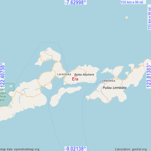
Era GPS coordinates[2]
8° 19' 34.68" South, 123° 6' 38.52" East
| Map corner | latitude | longitude |
|---|---|---|
| Upper-left | -7.62998°, | 122.40758° |
| Center: | -8.3263°, | 123.1107° |
| Lower-right: | -9.02138°, | 123.81383° |
| Map W x H: | 154.7×154.7 km | = 96.1×96.1mi |
| max Lat: | 5.88969° ⇑78% North |
| Era: | -8.3263° |
| min Lat: | ⇓22% South -10.934° |
| min Long | Era | max Long |
| 95.1345° | 123.1107° | 140.9419° |
| W 90.7%⇐ | ⇒9.3% E |
Elevation
Elevation of Era is 588 m = 1929 ft, and this is 358.3 m = 1176 ft above average elevation for this country.
| Max E: |
3185 m = 10449 ft | 11.9% |
| Era | 588 m 1929 ft | |
| Avg. | 229.7 m = 754 ft | |
Min E: |
-1 m = -3 ft | 88.1% |
See also: Indonesia elevation on elevation.city.
Geographical zone
Era is located in South Torrid zone (between Equator and Tropic of Capricorn). Distance of Equator is 925.8 km =575.3 mi to North.| Distance of | km | miles | from Era |
|---|---|---|---|
| Equator | 925.8 | 575.3 | to North |
| Tropic Capricorn | 1680.1 | 1044 | to South |
| Antarctic Circle | 6475.4 | 4023.6 | to South |
| South Pole | 9081.3 | 5642.9 | to South |


Nearby cities:
15 places around Era: (largest is in red/bold)
• Bayuwan
3.4 km =2.1 mi,  79°
79°
• Ipiebang
5.1 km =3.2 mi,  151°
151°
• Kanariblolong
6.2 km =3.9 mi,  311°
311°
• Lamaluwo
5.2 km =3.2 mi,  111°
111°
• Leter
1.2 km =0.7 mi,  61°
61°
• Mulawato
4.4 km =2.7 mi,  89°
89°
• Papilawe
5.7 km =3.5 mi, 77°
• Riangpao
4.5 km =2.8 mi,  96°
96°
• Tanahpukang
4.5 km =2.8 mi, 75°
• Waibereno
4.1 km =2.5 mi, 56°
• Waitenepang
6.1 km =3.8 mi,  0°
0°
• Waiwadan
5.9 km =3.7 mi,  340°
340°
• Watodei
1.9 km =1.2 mi,  226°
226°
• Wayangona
5.5 km =3.4 mi,  235°
235°
• Wewit
5.8 km =3.6 mi, 61°
Sources, notices
• [Note1] Compared only with cities in Indonesia existing in our database
• [Src1] Map data: © OpenStreetMap contributors (CC-BY-SA)
• [Src2] Other city data from geonames.org with taken over terms of usage.
• [Src3] Geographical zone / Annual Mean Temperature by Robert A. Rohde @ Wikipedia
