Tanahpukang geodata
Tanahpukang (East Nusa Tenggara) is a seat of a fourth-order administrative division; located in Indonesia in Asia/Makassar (GMT+8) time zone. In our database, there are 407 cities with bigger population. Compared to other cities in Indonesia, 77.6% of cities are located further ↑North; 90.9% of cities are located further ←West and 88.4% of cities have lower elevation than Tanahpukang. Note1


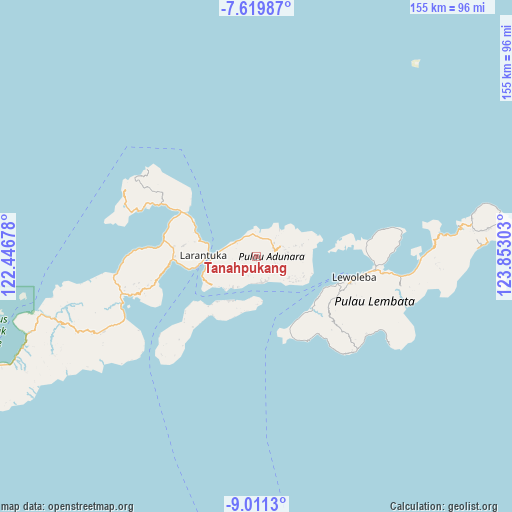
Tanahpukang GPS coordinates[2]
8° 18' 58.32" South, 123° 8' 59.64" East
| Map corner | latitude | longitude |
|---|---|---|
| Upper-left | -7.61987°, | 122.44678° |
| Center: | -8.3162°, | 123.1499° |
| Lower-right: | -9.0113°, | 123.85303° |
| Map W x H: | 154.7×154.7 km | = 96.1×96.1mi |
| max Lat: | 5.88969° ⇑77.6% North |
| Tanahpukang: | -8.3162° |
| min Lat: | ⇓22.4% South -10.934° |
| min Long | Tanahpukang | max Long |
| 95.1345° | 123.1499° | 140.9419° |
| W 90.9%⇐ | ⇒9.1% E |
Elevation
Elevation of Tanahpukang is 594 m = 1949 ft, and this is 364.3 m = 1195 ft above average elevation for this country.
| Max E: |
3185 m = 10449 ft | 11.6% |
| Tanahpukang | 594 m 1949 ft | |
| Avg. | 229.7 m = 754 ft | |
Min E: |
-1 m = -3 ft | 88.4% |
See also: Indonesia elevation on elevation.city.
Geographical zone
Tanahpukang is located in South Torrid zone (between Equator and Tropic of Capricorn). Distance of Equator is 924.7 km =574.6 mi to North.| Distance of | km | miles | from Tanahpukang |
|---|---|---|---|
| Equator | 924.7 | 574.6 | to North |
| Tropic Capricorn | 1681.2 | 1044.6 | to South |
| Antarctic Circle | 6476.5 | 4024.3 | to South |
| South Pole | 9082.4 | 5643.5 | to South |


Nearby cities:
15 places around Tanahpukang: (largest is in red/bold)
• Bayuwan
1.1 km =0.7 mi,  241°
241°
• Era
4.5 km =2.8 mi,  255°
255°
• Ipiebang
5.9 km =3.7 mi,  198°
198°
• Lamaluwo
3.1 km =1.9 mi,  171°
171°
• Leter
3.3 km =2.1 mi, 260°
• Lewonara
5.1 km =3.2 mi,  151°
151°
• Lowotukan
5.7 km =3.5 mi,  63°
63°
• Mulawato
1.1 km =0.7 mi,  176°
176°
• Ongabelen
6 km =3.7 mi,  109°
109°
• Papilawe
1.2 km =0.7 mi,  85°
85°
• Riangpao
1.6 km =1 mi, 173°
• Waibereno
1.4 km =0.9 mi,  323°
323°
• Wainira
5.3 km =3.3 mi,  69°
69°
• Watodei
6.2 km =3.9 mi,  246°
246°
• Wewit
1.8 km =1.1 mi,  26°
26°
Sources, notices
• [Note1] Compared only with cities in Indonesia existing in our database
• [Src1] Map data: © OpenStreetMap contributors (CC-BY-SA)
• [Src2] Other city data from geonames.org with taken over terms of usage.
• [Src3] Geographical zone / Annual Mean Temperature by Robert A. Rohde @ Wikipedia
