Waiwadan geodata
Waiwadan (East Nusa Tenggara) is a seat of a third-order administrative division; located in Indonesia in Asia/Makassar (GMT+8) time zone. In our database, there are 407 cities with bigger population. Compared to other cities in Indonesia, 75.5% of cities are located further ↑North; 90.7% of cities are located further ←West and 83% of cities have higher elevation than Waiwadan. Note1


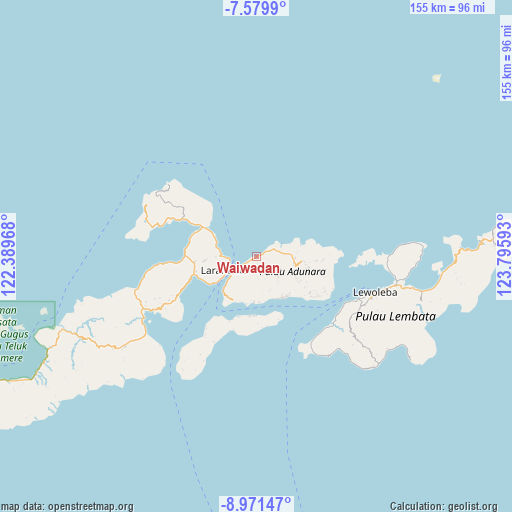
Waiwadan GPS coordinates[2]
8° 16' 34.68" South, 123° 5' 34.08" East
| Map corner | latitude | longitude |
|---|---|---|
| Upper-left | -7.5799°, | 122.38968° |
| Center: | -8.2763°, | 123.0928° |
| Lower-right: | -8.97147°, | 123.79593° |
| Map W x H: | 154.7×154.7 km | = 96.1×96.1mi |
| max Lat: | 5.88969° ⇑75.5% North |
| Waiwadan: | -8.2763° |
| min Lat: | ⇓24.5% South -10.934° |
| min Long | Waiwadan | max Long |
| 95.1345° | 123.0928° | 140.9419° |
| W 90.7%⇐ | ⇒9.3% E |
Elevation
Elevation of Waiwadan is 16 m = 52 ft, and this is 213.7 m = 701 ft below average elevation for this country.
| Max E: |
3185 m = 10449 ft | 83% |
| Avg. | 229.7 m = 754 ft | |
| Waiwadan | 16 m = 52 ft | |
Min E: |
-1 m = -3 ft | 17% |
See also: Indonesia elevation on elevation.city.
Geographical zone
Waiwadan is located in South Torrid zone (between Equator and Tropic of Capricorn). Distance of Equator is 920.2 km =571.8 mi to North.| Distance of | km | miles | from Waiwadan |
|---|---|---|---|
| Equator | 920.2 | 571.8 | to North |
| Tropic Capricorn | 1685.7 | 1047.4 | to South |
| Antarctic Circle | 6480.9 | 4027 | to South |
| South Pole | 9086.8 | 5646.3 | to South |


Nearby cities:
15 places around Waiwadan: (largest is in red/bold)
• Bayuwan
7.3 km =4.5 mi,  132°
132°
• Era
5.9 km =3.7 mi,  160°
160°
• Kanariblolong
3 km =1.9 mi,  241°
241°
• Kotakaya Dua
6.4 km =4 mi,  51°
51°
• Leter
5.8 km =3.6 mi,  148°
148°
• Mulawato
8.4 km =5.2 mi, 130°
• Papilawe
8.7 km =5.4 mi,  120°
120°
• Riangpao
8.9 km =5.5 mi, 133°
• Tanahpukang
7.7 km =4.8 mi, 125°
• Waibereno
6.4 km =4 mi, 121°
• Waitenepang
2.1 km =1.3 mi,  74°
74°
• Watodei
6.9 km =4.3 mi,  175°
175°
• Wayangona
9.1 km =5.7 mi,  196°
196°
• Wewit
7.6 km =4.7 mi,  111°
111°
• Wureh
6.5 km =4 mi, 239°
Sources, notices
• [Note1] Compared only with cities in Indonesia existing in our database
• [Src1] Map data: © OpenStreetMap contributors (CC-BY-SA)
• [Src2] Other city data from geonames.org with taken over terms of usage.
• [Src3] Geographical zone / Annual Mean Temperature by Robert A. Rohde @ Wikipedia
