Sawang geodata
Sawang (Aceh) is a seat of a third-order administrative division; located in Indonesia in Asia/Jakarta (GMT+7) time zone. In our database, there are 407 cities with bigger population. Compared to other cities in Indonesia, 98.2% of cities are located further ↓South; 99% of cities are located further →East and 57.8% of cities have lower elevation than Sawang. Note1


Sawang GPS coordinates[2]
3° 24' 12.312" North, 97° 6' 3.96" East
| Map corner | latitude | longitude |
|---|---|---|
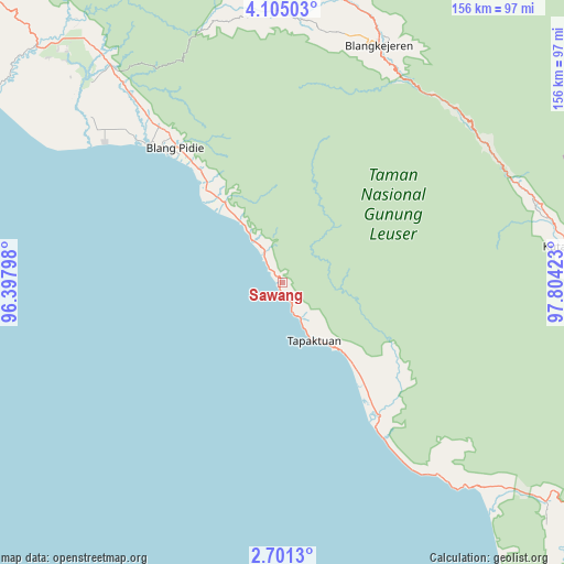
| Upper-left | 4.10503°, | 96.39798° |
| Center: | 3.40342°, | 97.1011° |
| Lower-right: | 2.7013°, | 97.80423° |
| Map W x H: | 156.1×156.1 km | = 97×97mi |
| max Lat: | 5.88969° ⇑1.8% North |
| Sawang: | 3.40342° |
| min Lat: | ⇓98.2% South -10.934° |
| min Long | Sawang | max Long |
| 95.1345° | 97.1011° | 140.9419° |
| W 1%⇐ | ⇒99% E |
Elevation
Elevation of Sawang is 144 m = 472 ft, and this is 85.7 m = 281 ft below average elevation for this country.
| Max E: |
3185 m = 10449 ft | 42.2% |
| Avg. | 229.7 m = 754 ft | |
| Sawang | 144 m = 472 ft | |
Min E: |
-1 m = -3 ft | 57.8% |
See also: Indonesia elevation on elevation.city.
Geographical zone
Sawang is located in North Torrid zone (between Equator and Tropic of Cancer). Distance of Equator is 378.4 km =235.1 mi to South.| Distance of | km | miles | from Sawang |
|---|---|---|---|
| North Pole | 9628.6 | 5982.9 | to North |
| Arctic Circle | 7022.7 | 4363.7 | to North |
| Tropic Cancer | 2227.5 | 1384.1 | to North |
| Equator | 378.4 | 235.1 | to South |


Nearby cities:
15 places around Sawang: (largest is in red/bold)
• Blangpidie
47.6 km =29.6 mi,  321°
321°
• Kota Trieng
26.6 km =16.5 mi, 324°
• Kotabahagia
59.3 km =36.8 mi, 321°
• Mersak
33.5 km =20.8 mi,  68°
68°
• Meukek
9.2 km =5.7 mi,  331°
331°
• Paya Dapur
41.2 km =25.6 mi,  121°
121°
• Peuleumat
15.8 km =9.8 mi, 330°
• Pulo Ie
31.3 km =19.4 mi, 115°
• Samadua
8.2 km =5.1 mi,  156°
156°
• Seupakat
48.2 km =30 mi,  56°
56°
• Suak Bakung
53 km =32.9 mi,  146°
146°
• Suek
51.9 km =32.2 mi, 322°
• Susoh
47.2 km =29.3 mi, 318°
• Tangantangancut
39.4 km =24.5 mi, 323°
• Terbangan
28.2 km =17.5 mi,  137°
137°
Sources, notices
• [Note1] Compared only with cities in Indonesia existing in our database
• [Src1] Map data: © OpenStreetMap contributors (CC-BY-SA)
• [Src2] Other city data from geonames.org with taken over terms of usage.
• [Src3] Geographical zone / Annual Mean Temperature by Robert A. Rohde @ Wikipedia
