Ngkan geodata
Ngkan (Aceh) is a seat of a third-order administrative division; located in Indonesia in Asia/Jakarta (GMT+7) time zone. In our database, there are 407 cities with bigger population. Compared to other cities in Indonesia, 98.2% of cities are located further ↓South; 98.7% of cities are located further →East and 99.5% of cities have lower elevation than Ngkan. Note1


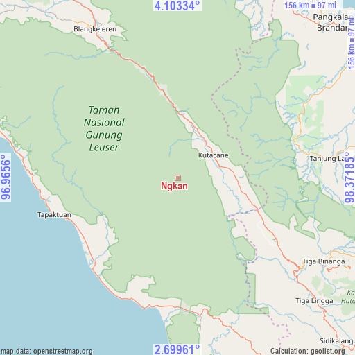
Ngkan GPS coordinates[2]
3° 24' 6.228" North, 97° 40' 7.392" East
| Map corner | latitude | longitude |
|---|---|---|
| Upper-left | 4.10334°, | 96.9656° |
| Center: | 3.40173°, | 97.66872° |
| Lower-right: | 2.69961°, | 98.37185° |
| Map W x H: | 156.1×156.1 km | = 97×97mi |
| max Lat: | 5.88969° ⇑1.8% North |
| Ngkan: | 3.40173° |
| min Lat: | ⇓98.2% South -10.934° |
| min Long | Ngkan | max Long |
| 95.1345° | 97.66872° | 140.9419° |
| W 1.3%⇐ | ⇒98.7% E |
Elevation
Elevation of Ngkan is 1315 m = 4314 ft, and this is 1085.3 m = 3561 ft above average elevation for this country.
| Max E: |
3185 m = 10449 ft | 0.5% |
| Ngkan | 1315 m 4314 ft | |
| Avg. | 229.7 m = 754 ft | |
Min E: |
-1 m = -3 ft | 99.5% |
See also: Indonesia elevation on elevation.city.
Geographical zone
Ngkan is located in North Torrid zone (between Equator and Tropic of Cancer). Distance of Equator is 378.2 km =235 mi to South.| Distance of | km | miles | from Ngkan |
|---|---|---|---|
| North Pole | 9628.8 | 5983.1 | to North |
| Arctic Circle | 7022.9 | 4363.8 | to North |
| Tropic Cancer | 2227.7 | 1384.2 | to North |
| Equator | 378.2 | 235 | to South |


Nearby cities:
15 places around Ngkan: (largest is in red/bold)
• Bakungan
57 km =35.4 mi,  201°
201°
• Bambol
24 km =14.9 mi,  77°
77°
• Krueng Luak
61.2 km =38 mi,  170°
170°
• Lawepakam
34.9 km =21.7 mi,  108°
108°
• Lawesigalagala Timur
31.3 km =19.4 mi,  104°
104°
• Mersak
34.2 km =21.3 mi,  291°
291°
• Paya Dapur
35.1 km =21.8 mi,  232°
232°
• Pulo Ie
37.2 km =23.1 mi,  249°
249°
• Pulopaya
58.8 km =36.5 mi,  181°
181°
• Samadua
60.2 km =37.4 mi,  262°
262°
• Sangir
56.1 km =34.9 mi,  343°
343°
• Seupakat
35.3 km =21.9 mi,  319°
319°
• Suak Bakung
55.5 km =34.5 mi,  217°
217°
• Tanah Merah
25.9 km =16.1 mi,  8°
8°
• Terbangan
48.7 km =30.3 mi,  244°
244°
Sources, notices
• [Note1] Compared only with cities in Indonesia existing in our database
• [Src1] Map data: © OpenStreetMap contributors (CC-BY-SA)
• [Src2] Other city data from geonames.org with taken over terms of usage.
• [Src3] Geographical zone / Annual Mean Temperature by Robert A. Rohde @ Wikipedia
