Lawepakam geodata
Lawepakam (Aceh) is a seat of a third-order administrative division; located in Indonesia in Asia/Jakarta (GMT+7) time zone. In our database, there are 407 cities with bigger population. Compared to other cities in Indonesia, 98.2% of cities are located further ↓South; 98.5% of cities are located further →East and 67.9% of cities have lower elevation than Lawepakam. Note1


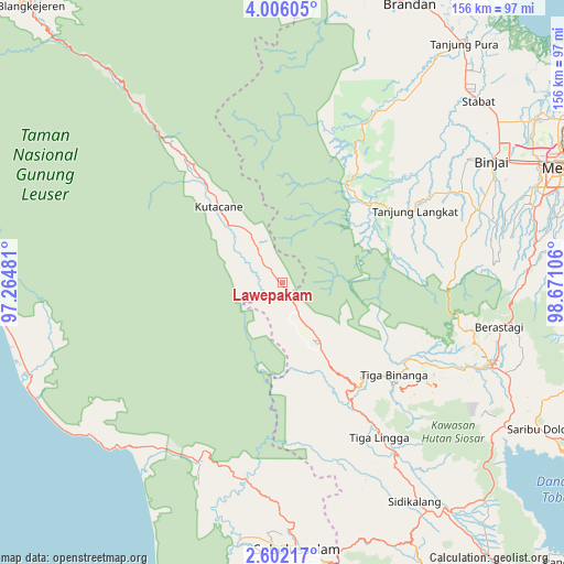
Lawepakam GPS coordinates[2]
3° 18' 15.696" North, 97° 58' 4.548" East
| Map corner | latitude | longitude |
|---|---|---|
| Upper-left | 4.00605°, | 97.26481° |
| Center: | 3.30436°, | 97.96793° |
| Lower-right: | 2.60217°, | 98.67106° |
| Map W x H: | 156.1×156.1 km | = 97×97mi |
| max Lat: | 5.88969° ⇑1.8% North |
| Lawepakam: | 3.30436° |
| min Lat: | ⇓98.2% South -10.934° |
| min Long | Lawepakam | max Long |
| 95.1345° | 97.96793° | 140.9419° |
| W 1.5%⇐ | ⇒98.5% E |
Elevation
Elevation of Lawepakam is 261 m = 856 ft, and this is 31.3 m = 103 ft above average elevation for this country.
| Max E: |
3185 m = 10449 ft | 32.1% |
| Lawepakam | 261 m 856 ft | |
| Avg. | 229.7 m = 754 ft | |
Min E: |
-1 m = -3 ft | 67.9% |
See also: Indonesia elevation on elevation.city.
Geographical zone
Lawepakam is located in North Torrid zone (between Equator and Tropic of Cancer). Distance of Equator is 367.4 km =228.3 mi to South.| Distance of | km | miles | from Lawepakam |
|---|---|---|---|
| North Pole | 9639.7 | 5989.8 | to North |
| Arctic Circle | 7033.8 | 4370.6 | to North |
| Tropic Cancer | 2238.5 | 1390.9 | to North |
| Equator | 367.4 | 228.3 | to South |


Nearby cities:
15 places around Lawepakam: (largest is in red/bold)
• Bakungan
68.5 km =42.6 mi,  231°
231°
• Bambol
18.9 km =11.7 mi,  328°
328°
• Berastagi
61.3 km =38.1 mi,  101°
101°
• Binjai
66.2 km =41.1 mi,  60°
60°
• Jambi Baru
59.1 km =36.7 mi,  188°
188°
• Kabanjahe
62.3 km =38.7 mi,  111°
111°
• Krueng Luak
54.8 km =34.1 mi,  205°
205°
• Lawesigalagala Timur
4.2 km =2.6 mi,  317°
317°
• Mersak
69.1 km =42.9 mi,  289°
289°
• Ngkan
34.9 km =21.7 mi, 288°
• Paya Dapur
62 km =38.5 mi,  260°
260°
• Pulo Ie
68 km =42.3 mi,  267°
267°
• Pulopaya
59.4 km =36.9 mi,  216°
216°
• Seupakat
67.6 km =42 mi,  303°
303°
• Tanah Merah
46.9 km =29.1 mi, 321°
Sources, notices
• [Note1] Compared only with cities in Indonesia existing in our database
• [Src1] Map data: © OpenStreetMap contributors (CC-BY-SA)
• [Src2] Other city data from geonames.org with taken over terms of usage.
• [Src3] Geographical zone / Annual Mean Temperature by Robert A. Rohde @ Wikipedia
