Bambol geodata
Bambol (Aceh) is a seat of a third-order administrative division; located in Indonesia in Asia/Jakarta (GMT+7) time zone. In our database, there are 407 cities with bigger population. Compared to other cities in Indonesia, 98.3% of cities are located further ↓South; 98.5% of cities are located further →East and 64.8% of cities have lower elevation than Bambol. Note1


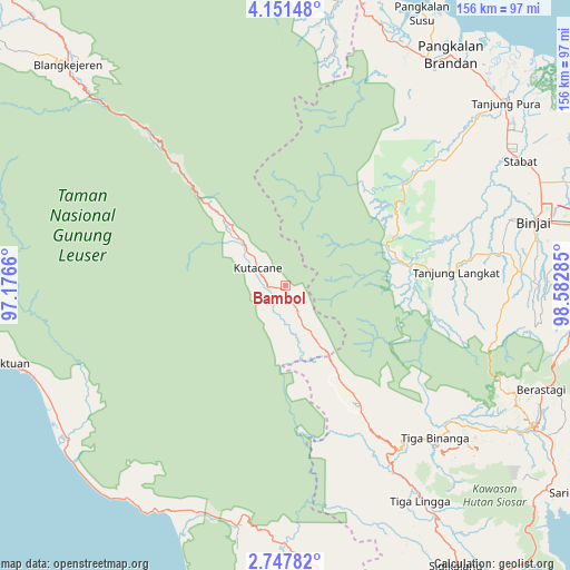
Bambol GPS coordinates[2]
3° 26' 59.676" North, 97° 52' 46.992" East
| Map corner | latitude | longitude |
|---|---|---|
| Upper-left | 4.15148°, | 97.1766° |
| Center: | 3.44991°, | 97.87972° |
| Lower-right: | 2.74782°, | 98.58285° |
| Map W x H: | 156.1×156.1 km | = 97×97mi |
| max Lat: | 5.88969° ⇑1.7% North |
| Bambol: | 3.44991° |
| min Lat: | ⇓98.3% South -10.934° |
| min Long | Bambol | max Long |
| 95.1345° | 97.87972° | 140.9419° |
| W 1.5%⇐ | ⇒98.5% E |
Elevation
Elevation of Bambol is 220 m = 722 ft, and this is 9.7 m = 32 ft below average elevation for this country.
| Max E: |
3185 m = 10449 ft | 35.2% |
| Avg. | 229.7 m = 754 ft | |
| Bambol | 220 m = 722 ft | |
Min E: |
-1 m = -3 ft | 64.8% |
See also: Indonesia elevation on elevation.city.
Geographical zone
Bambol is located in North Torrid zone (between Equator and Tropic of Cancer). Distance of Equator is 383.6 km =238.4 mi to South.| Distance of | km | miles | from Bambol |
|---|---|---|---|
| North Pole | 9623.5 | 5979.8 | to North |
| Arctic Circle | 7017.6 | 4360.5 | to North |
| Tropic Cancer | 2222.3 | 1380.9 | to North |
| Equator | 383.6 | 238.4 | to South |


Nearby cities:
15 places around Bambol: (largest is in red/bold)
• Binjai
69.3 km =43.1 mi,  76°
76°
• Krueng Luak
67.2 km =41.8 mi,  191°
191°
• Lawepakam
18.9 km =11.7 mi,  148°
148°
• Lawesigalagala Timur
14.8 km =9.2 mi, 152°
• Mersak
55.7 km =34.6 mi,  277°
277°
• Ngkan
24 km =14.9 mi,  257°
257°
• Paya Dapur
57.8 km =35.9 mi,  242°
242°
• Pulo Ie
61.1 km =38 mi,  252°
252°
• Pulopaya
68.9 km =42.8 mi,  201°
201°
• Sangir
62.3 km =38.7 mi,  321°
321°
• Seupakat
51 km =31.7 mi,  294°
294°
• Stabat
70.7 km =43.9 mi,  63°
63°
• Tanah Merah
28.3 km =17.6 mi, 315°
• Tenggulun
61.8 km =38.4 mi,  13°
13°
• Terbangan
72.4 km =45 mi, 248°
Sources, notices
• [Note1] Compared only with cities in Indonesia existing in our database
• [Src1] Map data: © OpenStreetMap contributors (CC-BY-SA)
• [Src2] Other city data from geonames.org with taken over terms of usage.
• [Src3] Geographical zone / Annual Mean Temperature by Robert A. Rohde @ Wikipedia
