Beutong Ateuh geodata
Beutong Ateuh (Aceh) is a seat of a third-order administrative division; located in Indonesia in Asia/Jakarta (GMT+7) time zone. In our database, there are 407 cities with bigger population. Compared to other cities in Indonesia, 99% of cities are located further ↓South; 99.4% of cities are located further →East and 51.4% of cities have higher elevation than Beutong Ateuh. Note1


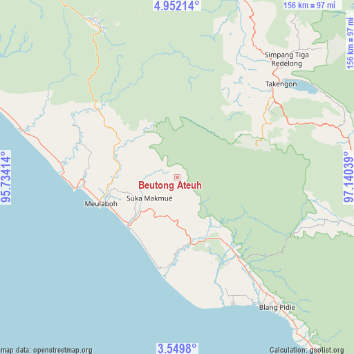
Beutong Ateuh GPS coordinates[2]
4° 15' 4.644" North, 96° 26' 14.136" East
| Map corner | latitude | longitude |
|---|---|---|
| Upper-left | 4.95214°, | 95.73414° |
| Center: | 4.25129°, | 96.43726° |
| Lower-right: | 3.5498°, | 97.14039° |
| Map W x H: | 155.9×155.9 km | = 96.9×96.9mi |
| max Lat: | 5.88969° ⇑1% North |
| Beutong Ateuh: | 4.25129° |
| min Lat: | ⇓99% South -10.934° |
| min Long | Beutong Ateuh | max Long |
| 95.1345° | 96.43726° | 140.9419° |
| W 0.6%⇐ | ⇒99.4% E |
Elevation
Elevation of Beutong Ateuh is 97 m = 318 ft, and this is 132.7 m = 435 ft below average elevation for this country.
| Max E: |
3185 m = 10449 ft | 51.4% |
| Avg. | 229.7 m = 754 ft | |
| Beutong Ateuh | 97 m = 318 ft | |
Min E: |
-1 m = -3 ft | 48.6% |
See also: Indonesia elevation on elevation.city.
Geographical zone
Beutong Ateuh is located in North Torrid zone (between Equator and Tropic of Cancer). Distance of Equator is 472.7 km =293.7 mi to South.| Distance of | km | miles | from Beutong Ateuh |
|---|---|---|---|
| North Pole | 9534.4 | 5924.4 | to North |
| Arctic Circle | 6928.5 | 4305.2 | to North |
| Tropic Cancer | 2133.2 | 1325.5 | to North |
| Equator | 472.7 | 293.7 | to South |


Nearby cities:
15 places around Beutong Ateuh: (largest is in red/bold)
• Alue Bilie
30.6 km =19 mi,  153°
153°
• Babah Rot
45.4 km =28.2 mi,  142°
142°
• Banda Layung
37.8 km =23.5 mi,  268°
268°
• Blang Ara
8.1 km =5 mi,  294°
294°
• Celala
47.6 km =29.6 mi,  36°
36°
• Jagongjeget
42.2 km =26.2 mi,  69°
69°
• Kajeung
44.7 km =27.8 mi,  310°
310°
• Keudee Aron
29 km =18 mi,  261°
261°
• Kuala Bhee
45.8 km =28.5 mi, 289°
• Kuala Tuha
30.2 km =18.8 mi,  225°
225°
• Meulaboh
36.5 km =22.7 mi,  250°
250°
• Meureubo
32.9 km =20.4 mi, 247°
• Pantai Ceuremen
29.8 km =18.5 mi,  296°
296°
• Rusip
50.1 km =31.1 mi,  22°
22°
• Suka Makmue
34.1 km =21.2 mi, 144°
Sources, notices
• [Note1] Compared only with cities in Indonesia existing in our database
• [Src1] Map data: © OpenStreetMap contributors (CC-BY-SA)
• [Src2] Other city data from geonames.org with taken over terms of usage.
• [Src3] Geographical zone / Annual Mean Temperature by Robert A. Rohde @ Wikipedia
