Kajeung geodata
Kajeung (Aceh) is a seat of a third-order administrative division; located in Indonesia in Asia/Jakarta (GMT+7) time zone. In our database, there are 407 cities with bigger population. Compared to other cities in Indonesia, 99.2% of cities are located further ↓South; 99.6% of cities are located further →East and 63.5% of cities have higher elevation than Kajeung. Note1


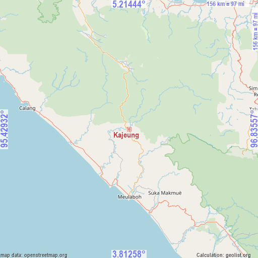
Kajeung GPS coordinates[2]
4° 30' 49.86" North, 96° 7' 56.784" East
| Map corner | latitude | longitude |
|---|---|---|
| Upper-left | 5.21444°, | 95.42932° |
| Center: | 4.51385°, | 96.13244° |
| Lower-right: | 3.81258°, | 96.83557° |
| Map W x H: | 155.9×155.9 km | = 96.9×96.9mi |
| max Lat: | 5.88969° ⇑0.8% North |
| Kajeung: | 4.51385° |
| min Lat: | ⇓99.2% South -10.934° |
| min Long | Kajeung | max Long |
| 95.1345° | 96.13244° | 140.9419° |
| W 0.4%⇐ | ⇒99.6% E |
Elevation
Elevation of Kajeung is 47 m = 154 ft, and this is 182.7 m = 599 ft below average elevation for this country.
| Max E: |
3185 m = 10449 ft | 63.5% |
| Avg. | 229.7 m = 754 ft | |
| Kajeung | 47 m = 154 ft | |
Min E: |
-1 m = -3 ft | 36.5% |
See also: Indonesia elevation on elevation.city.
Geographical zone
Kajeung is located in North Torrid zone (between Equator and Tropic of Cancer). Distance of Equator is 501.9 km =311.9 mi to South.| Distance of | km | miles | from Kajeung |
|---|---|---|---|
| North Pole | 9505.2 | 5906.3 | to North |
| Arctic Circle | 6899.3 | 4287 | to North |
| Tropic Cancer | 2104 | 1307.4 | to North |
| Equator | 501.9 | 311.9 | to South |


Nearby cities:
15 places around Kajeung: (largest is in red/bold)
• Banda Layung
30.5 km =19 mi,  187°
187°
• Beutong Ateuh
44.7 km =27.8 mi,  130°
130°
• Blang Ara
36.9 km =22.9 mi, 134°
• Drien Rampak
29.8 km =18.5 mi,  220°
220°
• Geumpang
35.2 km =21.9 mi,  5°
5°
• Kalde Panga
46.5 km =28.9 mi,  275°
275°
• Keudee Aron
33.7 km =20.9 mi,  171°
171°
• Kuala Bhee
17.1 km =10.6 mi,  213°
213°
• Kuala Tuha
52 km =32.3 mi, 166°
• Mane
49.2 km =30.6 mi,  343°
343°
• Meulaboh
41.1 km =25.5 mi,  180°
180°
• Meureubo
41.7 km =25.9 mi, 175°
• Pantai Ceuremen
17.6 km =10.9 mi,  156°
156°
• Rusip
55.6 km =34.5 mi,  72°
72°
• Tangse
60.6 km =37.7 mi, 336°
Sources, notices
• [Note1] Compared only with cities in Indonesia existing in our database
• [Src1] Map data: © OpenStreetMap contributors (CC-BY-SA)
• [Src2] Other city data from geonames.org with taken over terms of usage.
• [Src3] Geographical zone / Annual Mean Temperature by Robert A. Rohde @ Wikipedia
