Allealle geodata
Allealle (South Kalimantan) is a seat of a third-order administrative division; located in Indonesia in Asia/Makassar (GMT+8) time zone. In our database, there are 407 cities with bigger population. Compared to other cities in Indonesia, 89.6% of cities are located further ↓South; 76.7% of cities are located further ←West and 76.2% of cities have higher elevation than Allealle. Note1


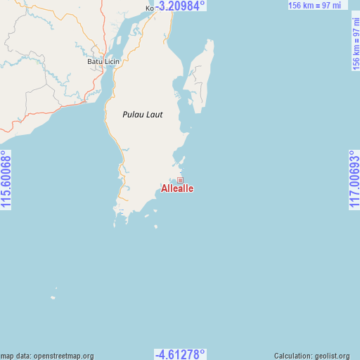
Allealle GPS coordinates[2]
3° 54' 41.76" South, 116° 18' 13.68" East
| Map corner | latitude | longitude |
|---|---|---|
| Upper-left | -3.20984°, | 115.60068° |
| Center: | -3.9116°, | 116.3038° |
| Lower-right: | -4.61278°, | 117.00693° |
| Map W x H: | 156×156 km | = 96.9×96.9mi |
| max Lat: | 5.88969° ⇑10.4% North |
| Allealle: | -3.9116° |
| min Lat: | ⇓89.6% South -10.934° |
| min Long | Allealle | max Long |
| 95.1345° | 116.3038° | 140.9419° |
| W 76.7%⇐ | ⇒23.3% E |
Elevation
Elevation of Allealle is 23 m = 75 ft, and this is 206.7 m = 678 ft below average elevation for this country.
| Max E: |
3185 m = 10449 ft | 76.2% |
| Avg. | 229.7 m = 754 ft | |
| Allealle | 23 m = 75 ft | |
Min E: |
-1 m = -3 ft | 23.8% |
See also: Indonesia elevation on elevation.city.
Geographical zone
Allealle is located in South Torrid zone (between Equator and Tropic of Capricorn). Distance of Equator is 434.9 km =270.2 mi to North.| Distance of | km | miles | from Allealle |
|---|---|---|---|
| Equator | 434.9 | 270.2 | to North |
| Tropic Capricorn | 2171 | 1349 | to South |
| Antarctic Circle | 6966.2 | 4328.6 | to South |
| South Pole | 9572.1 | 5947.8 | to South |


Nearby cities:
15 places around Allealle: (largest is in red/bold)
• Batulicin
63.8 km =39.6 mi,  328°
328°
• Binawara
73.7 km =45.8 mi,  309°
309°
• Gunungbatubesar
143.5 km =89.2 mi,  359°
359°
• Hampang
122 km =75.8 mi, 334°
• Kotabaru Hilir
74.9 km =46.5 mi,  353°
353°
• Lontar
26.9 km =16.7 mi,  254°
254°
• Pagatan
52.8 km =32.8 mi, 309°
• Pangaron
139.9 km =86.9 mi,  298°
298°
• Pantai
88.8 km =55.2 mi, 347°
• Pudi
113.9 km =70.8 mi,  2°
2°
• Satui
95 km =59 mi,  278°
278°
• Stagen
68.9 km =42.8 mi, 348°
• Sungaibali
57.7 km =35.9 mi,  11°
11°
• Sungaikupang
102.5 km =63.7 mi,  340°
340°
• Tanjungbatu
101.7 km =63.2 mi, 354°
Sources, notices
• [Note1] Compared only with cities in Indonesia existing in our database
• [Src1] Map data: © OpenStreetMap contributors (CC-BY-SA)
• [Src2] Other city data from geonames.org with taken over terms of usage.
• [Src3] Geographical zone / Annual Mean Temperature by Robert A. Rohde @ Wikipedia
