Cemaga geodata
Cemaga (Riau Islands) is a seat of a third-order administrative division; located in Indonesia in Asia/Jakarta (GMT+7) time zone. In our database, there are 407 cities with bigger population. Compared to other cities in Indonesia, 98.6% of cities are located further ↓South; 73.5% of cities are located further →East and 87.7% of cities have higher elevation than Cemaga. Note1


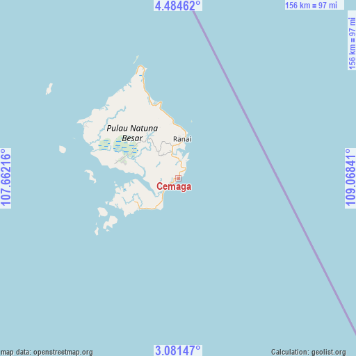
Cemaga GPS coordinates[2]
3° 46' 59.988" North, 108° 21' 55.008" East
| Map corner | latitude | longitude |
|---|---|---|
| Upper-left | 4.48462°, | 107.66216° |
| Center: | 3.78333°, | 108.36528° |
| Lower-right: | 3.08147°, | 109.06841° |
| Map W x H: | 156×156 km | = 96.9×96.9mi |
| max Lat: | 5.88969° ⇑1.4% North |
| Cemaga: | 3.78333° |
| min Lat: | ⇓98.6% South -10.934° |
| min Long | Cemaga | max Long |
| 95.1345° | 108.36528° | 140.9419° |
| W 26.5%⇐ | ⇒73.5% E |
Elevation
Elevation of Cemaga is 12 m = 39 ft, and this is 217.7 m = 714 ft below average elevation for this country.
| Max E: |
3185 m = 10449 ft | 87.7% |
| Avg. | 229.7 m = 754 ft | |
| Cemaga | 12 m = 39 ft | |
Min E: |
-1 m = -3 ft | 12.3% |
See also: Indonesia elevation on elevation.city.
Geographical zone
Cemaga is located in North Torrid zone (between Equator and Tropic of Cancer). Distance of Equator is 420.7 km =261.4 mi to South.| Distance of | km | miles | from Cemaga |
|---|---|---|---|
| North Pole | 9586.4 | 5956.7 | to North |
| Arctic Circle | 6980.5 | 4337.5 | to North |
| Tropic Cancer | 2185.3 | 1357.9 | to North |
| Equator | 420.7 | 261.4 | to South |


Nearby cities:
15 places around Cemaga: (largest is in red/bold)
• Harapan Jaya
12.3 km =7.6 mi,  325°
325°
• Kelarik
47.8 km =29.7 mi,  301°
301°
• Letung
308 km =191.4 mi,  253°
253°
• Matak
235.2 km =146.1 mi,  258°
258°
• Pemangkat
298.5 km =185.5 mi,  167°
167°
• Ranai
17.4 km =10.8 mi,  6°
6°
• Sabang Barat
109.8 km =68.2 mi,  218°
218°
• Sabang Mawang Barat
32.6 km =20.3 mi,  239°
239°
• Samalantan
345.1 km =214.4 mi,  164°
164°
• Sambas
289.6 km =179.9 mi, 160°
• Sedanau
37.3 km =23.2 mi,  271°
271°
• Serasan
159.6 km =99.2 mi,  152°
152°
• Singkawang
326.9 km =203.1 mi, 167°
• Tanjung
25.9 km =16.1 mi,  354°
354°
• Tarempa
246.6 km =153.2 mi, 255°
Sources, notices
• [Note1] Compared only with cities in Indonesia existing in our database
• [Src1] Map data: © OpenStreetMap contributors (CC-BY-SA)
• [Src2] Other city data from geonames.org with taken over terms of usage.
• [Src3] Geographical zone / Annual Mean Temperature by Robert A. Rohde @ Wikipedia
