Harapan Jaya geodata
Harapan Jaya (Riau Islands) is a seat of a third-order administrative division; located in Indonesia in Asia/Jakarta (GMT+7) time zone. In our database, there are 407 cities with bigger population. Compared to other cities in Indonesia, 98.7% of cities are located further ↓South; 74.6% of cities are located further →East and 70.7% of cities have higher elevation than Harapan Jaya. Note1


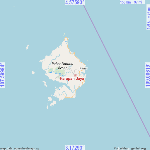
Harapan Jaya GPS coordinates[2]
3° 52' 28.992" North, 108° 18' 11.016" East
| Map corner | latitude | longitude |
|---|---|---|
| Upper-left | 4.57593°, | 107.59994° |
| Center: | 3.87472°, | 108.30306° |
| Lower-right: | 3.17293°, | 109.00619° |
| Map W x H: | 156×156 km | = 96.9×96.9mi |
| max Lat: | 5.88969° ⇑1.3% North |
| Harapan Jaya: | 3.87472° |
| min Lat: | ⇓98.7% South -10.934° |
| min Long | Harapan Jaya | max Long |
| 95.1345° | 108.30306° | 140.9419° |
| W 25.4%⇐ | ⇒74.6% E |
Elevation
Elevation of Harapan Jaya is 31 m = 102 ft, and this is 198.7 m = 652 ft below average elevation for this country.
| Max E: |
3185 m = 10449 ft | 70.7% |
| Avg. | 229.7 m = 754 ft | |
| Harapan Jaya | 31 m = 102 ft | |
Min E: |
-1 m = -3 ft | 29.3% |
See also: Indonesia elevation on elevation.city.
Geographical zone
Harapan Jaya is located in North Torrid zone (between Equator and Tropic of Cancer). Distance of Equator is 430.8 km =267.7 mi to South.| Distance of | km | miles | from Harapan Jaya |
|---|---|---|---|
| North Pole | 9576.2 | 5950.4 | to North |
| Arctic Circle | 6970.3 | 4331.1 | to North |
| Tropic Cancer | 2175.1 | 1351.5 | to North |
| Equator | 430.8 | 267.7 | to South |


Nearby cities:
15 places around Harapan Jaya: (largest is in red/bold)
• Cemaga
12.3 km =7.6 mi,  145°
145°
• Kelarik
36.9 km =22.9 mi,  293°
293°
• Letung
304.5 km =189.2 mi,  251°
251°
• Matak
230.8 km =143.4 mi,  255°
255°
• Pemangkat
310 km =192.6 mi,  166°
166°
• Ranai
11.4 km =7.1 mi,  51°
51°
• Sabang Barat
114.1 km =70.9 mi,  212°
212°
• Sabang Mawang Barat
34.1 km =21.2 mi,  218°
218°
• Samalantan
356.8 km =221.7 mi,  163°
163°
• Sambas
301.5 km =187.3 mi, 159°
• Sedanau
31.7 km =19.7 mi, 253°
• Serasan
171.8 km =106.8 mi, 151°
• Singkawang
338.3 km =210.2 mi, 167°
• Tanjung
16.3 km =10.1 mi,  15°
15°
• Tarempa
242.8 km =150.9 mi, 252°
Sources, notices
• [Note1] Compared only with cities in Indonesia existing in our database
• [Src1] Map data: © OpenStreetMap contributors (CC-BY-SA)
• [Src2] Other city data from geonames.org with taken over terms of usage.
• [Src3] Geographical zone / Annual Mean Temperature by Robert A. Rohde @ Wikipedia
