Lasusua geodata
Lasusua (Southeast Sulawesi) is a seat of a second-order administrative division; located in Indonesia in Asia/Makassar (GMT+8) time zone. In our database, there are 407 cities with bigger population. Compared to other cities in Indonesia, 90.3% of cities are located further ↓South; 85.3% of cities are located further ←West and 95.5% of cities have higher elevation than Lasusua. Note1


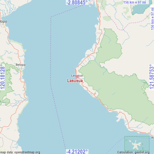
Lasusua GPS coordinates[2]
3° 30' 37.8" South, 120° 53' 3.84" East
| Map corner | latitude | longitude |
|---|---|---|
| Upper-left | -2.80845°, | 120.18128° |
| Center: | -3.5105°, | 120.8844° |
| Lower-right: | -4.21202°, | 121.58753° |
| Map W x H: | 156.1×156.1 km | = 97×97mi |
| max Lat: | 5.88969° ⇑9.7% North |
| Lasusua: | -3.5105° |
| min Lat: | ⇓90.3% South -10.934° |
| min Long | Lasusua | max Long |
| 95.1345° | 120.8844° | 140.9419° |
| W 85.3%⇐ | ⇒14.7% E |
Elevation
Elevation of Lasusua is 7 m = 23 ft, and this is 222.7 m = 731 ft below average elevation for this country.
| Max E: |
3185 m = 10449 ft | 95.5% |
| Avg. | 229.7 m = 754 ft | |
| Lasusua | 7 m = 23 ft | |
Min E: |
-1 m = -3 ft | 4.5% |
See also: Indonesia elevation on elevation.city.
Geographical zone
Lasusua is located in South Torrid zone (between Equator and Tropic of Capricorn). Distance of Equator is 390.3 km =242.5 mi to North.| Distance of | km | miles | from Lasusua |
|---|---|---|---|
| Equator | 390.3 | 242.5 | to North |
| Tropic Capricorn | 2215.6 | 1376.7 | to South |
| Antarctic Circle | 7010.8 | 4356.3 | to South |
| South Pole | 9616.7 | 5975.5 | to South |


Nearby cities:
15 places around Lasusua: (largest is in red/bold)
• Bajo
65.4 km =40.6 mi,  282°
282°
• Batuputih
99.3 km =61.7 mi,  308°
308°
• Belopa
59 km =36.7 mi, 283°
• Beringinjaya
93.9 km =58.3 mi, 306°
• Beuma
98.1 km =61 mi,  289°
289°
• Bonebone
109 km =67.7 mi,  338°
338°
• Jalang
85.7 km =53.3 mi,  226°
226°
• Kolaka
100.7 km =62.6 mi,  127°
127°
• Larompong
57 km =35.4 mi,  269°
269°
• Lempokasi
57.8 km =35.9 mi, 276°
• Malili
100.1 km =62.2 mi,  13°
13°
• Padangsappa
71.7 km =44.6 mi,  295°
295°
• Palopo
95.6 km =59.4 mi, 307°
• Siwa
56.1 km =34.9 mi,  247°
247°
• Wotu
102.7 km =63.8 mi,  355°
355°
Sources, notices
• [Note1] Compared only with cities in Indonesia existing in our database
• [Src1] Map data: © OpenStreetMap contributors (CC-BY-SA)
• [Src2] Other city data from geonames.org with taken over terms of usage.
• [Src3] Geographical zone / Annual Mean Temperature by Robert A. Rohde @ Wikipedia
