Larompong geodata
Larompong (South Sulawesi) is a seat of a third-order administrative division; located in Indonesia in Asia/Makassar (GMT+8) time zone. In our database, there are 407 cities with bigger population. Compared to other cities in Indonesia, 90.3% of cities are located further ↓South; 83.9% of cities are located further ←West and 83% of cities have higher elevation than Larompong. Note1


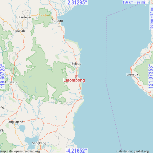
Larompong GPS coordinates[2]
3° 30' 54" South, 120° 22' 13.44" East
| Map corner | latitude | longitude |
|---|---|---|
| Upper-left | -2.81295°, | 119.66728° |
| Center: | -3.515°, | 120.3704° |
| Lower-right: | -4.21652°, | 121.07353° |
| Map W x H: | 156.1×156.1 km | = 97×97mi |
| max Lat: | 5.88969° ⇑9.7% North |
| Larompong: | -3.515° |
| min Lat: | ⇓90.3% South -10.934° |
| min Long | Larompong | max Long |
| 95.1345° | 120.3704° | 140.9419° |
| W 83.9%⇐ | ⇒16.1% E |
Elevation
Elevation of Larompong is 16 m = 52 ft, and this is 213.7 m = 701 ft below average elevation for this country.
| Max E: |
3185 m = 10449 ft | 83% |
| Avg. | 229.7 m = 754 ft | |
| Larompong | 16 m = 52 ft | |
Min E: |
-1 m = -3 ft | 17% |
See also: Indonesia elevation on elevation.city.
Geographical zone
Larompong is located in South Torrid zone (between Equator and Tropic of Capricorn). Distance of Equator is 390.8 km =242.8 mi to North.| Distance of | km | miles | from Larompong |
|---|---|---|---|
| Equator | 390.8 | 242.8 | to North |
| Tropic Capricorn | 2215.1 | 1376.4 | to South |
| Antarctic Circle | 7010.3 | 4356 | to South |
| South Pole | 9616.2 | 5975.2 | to South |


Nearby cities:
15 places around Larompong: (largest is in red/bold)
• Bajo
16.6 km =10.3 mi,  336°
336°
• Baraka
58.3 km =36.2 mi,  281°
281°
• Batuputih
65.4 km =40.6 mi, 341°
• Belajen
64.3 km =40 mi,  289°
289°
• Belopa
14.5 km =9 mi,  358°
358°
• Beringinjaya
59.3 km =36.8 mi, 342°
• Beuma
48.8 km =30.3 mi,  313°
313°
• Cakke
64.5 km =40.1 mi, 280°
• Getengan
65.5 km =40.7 mi,  304°
304°
• Jalang
58.4 km =36.3 mi,  185°
185°
• Lasusua
57 km =35.4 mi,  89°
89°
• Lempokasi
6.6 km =4.1 mi, 355°
• Padangsappa
32.1 km =19.9 mi,  346°
346°
• Palopo
61.2 km =38 mi, 341°
• Siwa
21.2 km =13.2 mi,  166°
166°
Sources, notices
• [Note1] Compared only with cities in Indonesia existing in our database
• [Src1] Map data: © OpenStreetMap contributors (CC-BY-SA)
• [Src2] Other city data from geonames.org with taken over terms of usage.
• [Src3] Geographical zone / Annual Mean Temperature by Robert A. Rohde @ Wikipedia
