Bonebone geodata
Bonebone (South Sulawesi) is a seat of a third-order administrative division; located in Indonesia in Asia/Makassar (GMT+8) time zone. In our database, there are 407 cities with bigger population. Compared to other cities in Indonesia, 92% of cities are located further ↓South; 84.3% of cities are located further ←West and 76.2% of cities have higher elevation than Bonebone. Note1


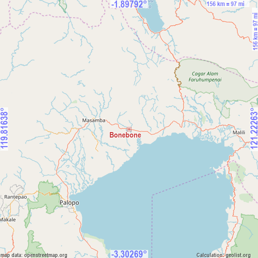
Bonebone GPS coordinates[2]
2° 36' 1.8" South, 120° 31' 10.2" East
| Map corner | latitude | longitude |
|---|---|---|
| Upper-left | -1.89792°, | 119.81638° |
| Center: | -2.6005°, | 120.5195° |
| Lower-right: | -3.30269°, | 121.22263° |
| Map W x H: | 156.2×156.2 km | = 97.1×97.1mi |
| max Lat: | 5.88969° ⇑8% North |
| Bonebone: | -2.6005° |
| min Lat: | ⇓92% South -10.934° |
| min Long | Bonebone | max Long |
| 95.1345° | 120.5195° | 140.9419° |
| W 84.3%⇐ | ⇒15.7% E |
Elevation
Elevation of Bonebone is 23 m = 75 ft, and this is 206.7 m = 678 ft below average elevation for this country.
| Max E: |
3185 m = 10449 ft | 76.2% |
| Avg. | 229.7 m = 754 ft | |
| Bonebone | 23 m = 75 ft | |
Min E: |
-1 m = -3 ft | 23.8% |
See also: Indonesia elevation on elevation.city.
Geographical zone
Bonebone is located in South Torrid zone (between Equator and Tropic of Capricorn). Distance of Equator is 289.1 km =179.6 mi to North.| Distance of | km | miles | from Bonebone |
|---|---|---|---|
| Equator | 289.1 | 179.6 | to North |
| Tropic Capricorn | 2316.8 | 1439.6 | to South |
| Antarctic Circle | 7112 | 4419.2 | to South |
| South Pole | 9717.9 | 6038.4 | to South |


Nearby cities:
15 places around Bonebone: (largest is in red/bold)
• Batuputih
54.7 km =34 mi,  223°
223°
• Beringinjaya
57.1 km =35.5 mi, 217°
• Lamasi
45.1 km =28 mi,  237°
237°
• Malili
64 km =39.8 mi,  93°
93°
• Mangkutana
34.8 km =21.6 mi,  69°
69°
• Masamba
21.9 km =13.6 mi,  283°
283°
• Padangsappa
74.6 km =46.4 mi,  199°
199°
• Palopo
56.4 km =35 mi, 219°
• Pendolo
61.3 km =38.1 mi,  17°
17°
• Rantepang
73.7 km =45.8 mi, 240°
• Rantepao
80.3 km =49.9 mi, 239°
• Sukamaju
6 km =3.7 mi,  260°
260°
• Walenrang
51.6 km =32.1 mi, 238°
• Wonorejo
34.7 km =21.6 mi, 69°
• Wotu
31.6 km =19.6 mi, 88°
Sources, notices
• [Note1] Compared only with cities in Indonesia existing in our database
• [Src1] Map data: © OpenStreetMap contributors (CC-BY-SA)
• [Src2] Other city data from geonames.org with taken over terms of usage.
• [Src3] Geographical zone / Annual Mean Temperature by Robert A. Rohde @ Wikipedia
