Muara Enim geodata
Muara Enim (South Sumatra) is a seat of a second-order administrative division; located in Indonesia in Asia/Jakarta (GMT+7) time zone. In our database, there are 407 cities with bigger population. Compared to other cities in Indonesia, 90.1% of cities are located further ↓South; 95.3% of cities are located further →East and 65.6% of cities have higher elevation than Muara Enim. Note1


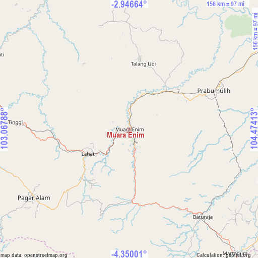
Muara Enim GPS coordinates[2]
3° 38' 54.96" South, 103° 46' 15.6" East
| Map corner | latitude | longitude |
|---|---|---|
| Upper-left | -2.94664°, | 103.06788° |
| Center: | -3.6486°, | 103.771° |
| Lower-right: | -4.35001°, | 104.47413° |
| Map W x H: | 156×156 km | = 96.9×96.9mi |
| max Lat: | 5.88969° ⇑9.9% North |
| Muara Enim: | -3.6486° |
| min Lat: | ⇓90.1% South -10.934° |
| min Long | Muara Enim | max Long |
| 95.1345° | 103.771° | 140.9419° |
| W 4.7%⇐ | ⇒95.3% E |
Elevation
Elevation of Muara Enim is 41 m = 135 ft, and this is 188.7 m = 619 ft below average elevation for this country.
| Max E: |
3185 m = 10449 ft | 65.6% |
| Avg. | 229.7 m = 754 ft | |
| Muara Enim | 41 m = 135 ft | |
Min E: |
-1 m = -3 ft | 34.4% |
See also: Indonesia elevation on elevation.city.
Geographical zone
Muara Enim is located in South Torrid zone (between Equator and Tropic of Capricorn). Distance of Equator is 405.7 km =252.1 mi to North.| Distance of | km | miles | from Muara Enim |
|---|---|---|---|
| Equator | 405.7 | 252.1 | to North |
| Tropic Capricorn | 2200.2 | 1367.1 | to South |
| Antarctic Circle | 6995.5 | 4346.8 | to South |
| South Pole | 9601.4 | 5966 | to South |


Nearby cities:
15 places around Muara Enim: (largest is in red/bold)
• Baturaja
69.1 km =42.9 mi,  140°
140°
• Bunga Mas
45 km =28 mi,  262°
262°
• Gunungmegang Dalam
24.7 km =15.3 mi,  26°
26°
• Gunungmenang
59.7 km =37.1 mi, 29°
• Kotaagung
60 km =37.3 mi,  218°
218°
• Lahat
29.5 km =18.3 mi,  239°
239°
• Muaradua
55.1 km =34.2 mi,  198°
198°
• Negeriagung
18.7 km =11.6 mi,  225°
225°
• Pagar Alam
71.6 km =44.5 mi, 234°
• Pengandonan
46.6 km =29 mi,  165°
165°
• Prabumulih
56.3 km =35 mi,  64°
64°
• Pulaupinang
38.7 km =24 mi, 225°
• Suban Jeriji
24 km =14.9 mi,  116°
116°
• Talang Ubi
43 km =26.7 mi,  8°
8°
• Tanjungagung
32.3 km =20.1 mi, 173°
Sources, notices
• [Note1] Compared only with cities in Indonesia existing in our database
• [Src1] Map data: © OpenStreetMap contributors (CC-BY-SA)
• [Src2] Other city data from geonames.org with taken over terms of usage.
• [Src3] Geographical zone / Annual Mean Temperature by Robert A. Rohde @ Wikipedia
