Magetan geodata
Magetan (East Java) is a seat of a second-order administrative division; located in Indonesia in Asia/Jakarta (GMT+7) time zone. In our database, there are 407 cities with bigger population. Compared to other cities in Indonesia, 59% of cities are located further ↑North; 61.3% of cities are located further →East and 74.8% of cities have lower elevation than Magetan. Note1


Magetan GPS coordinates[2]
7° 39' 24.012" South, 111° 19' 53.004" East
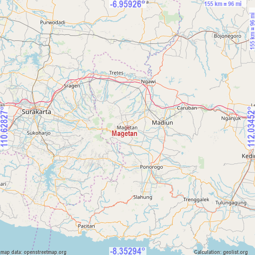
| Map corner | latitude | longitude |
|---|---|---|
| Upper-left | -6.95926°, | 110.62827° |
| Center: | -7.65667°, | 111.33139° |
| Lower-right: | -8.35294°, | 112.03452° |
| Map W x H: | 155×155 km | = 96.3×96.3mi |
| max Lat: | 5.88969° ⇑59% North |
| Magetan: | -7.65667° |
| min Lat: | ⇓41% South -10.934° |
| min Long | Magetan | max Long |
| 95.1345° | 111.33139° | 140.9419° |
| W 38.7%⇐ | ⇒61.3% E |
Elevation
Elevation of Magetan is 356 m = 1168 ft, and this is 126.3 m = 414 ft above average elevation for this country.
| Max E: |
3185 m = 10449 ft | 25.2% |
| Magetan | 356 m 1168 ft | |
| Avg. | 229.7 m = 754 ft | |
Min E: |
-1 m = -3 ft | 74.8% |
See also: Indonesia elevation on elevation.city.
Geographical zone
Magetan is located in South Torrid zone (between Equator and Tropic of Capricorn). Distance of Equator is 851.3 km =529 mi to North.| Distance of | km | miles | from Magetan |
|---|---|---|---|
| Equator | 851.3 | 529 | to North |
| Tropic Capricorn | 1754.6 | 1090.3 | to South |
| Antarctic Circle | 6549.8 | 4069.9 | to South |
| South Pole | 9155.7 | 5689.1 | to South |


Nearby cities:
15 places around Magetan: (largest is in red/bold)
• Banggel
39.6 km =24.6 mi,  165°
165°
• Beluk
40.7 km =25.3 mi,  161°
161°
• Bungkal
41.3 km =25.7 mi, 160°
• Caruban
37.9 km =23.5 mi,  70°
70°
• Jatiroto
34.6 km =21.5 mi,  223°
223°
• Krajan Menggare
40.8 km =25.4 mi, 166°
• Krajan Tengah
40.3 km =25 mi, 172°
• Kudo
41.1 km =25.5 mi, 161°
• Madiun
21.4 km =13.3 mi,  81°
81°
• Maron
40.1 km =24.9 mi, 165°
• Melikan
40 km =24.9 mi, 166°
• Nambak Tengah
41.2 km =25.6 mi, 162°
• Ngawi
30.8 km =19.1 mi,  24°
24°
• Ponorogo
27.6 km =17.1 mi,  148°
148°
• Setono
40.6 km =25.2 mi, 164°
Sources, notices
• [Note1] Compared only with cities in Indonesia existing in our database
• [Src1] Map data: © OpenStreetMap contributors (CC-BY-SA)
• [Src2] Other city data from geonames.org with taken over terms of usage.
• [Src3] Geographical zone / Annual Mean Temperature by Robert A. Rohde @ Wikipedia
