Caruban geodata
Caruban (East Java) is a seat of a second-order administrative division; located in Indonesia in Asia/Jakarta (GMT+7) time zone. In our database, there are 407 cities with bigger population. Compared to other cities in Indonesia, 57% of cities are located further ↑North; 55.3% of cities are located further →East and 55.7% of cities have higher elevation than Caruban. Note1


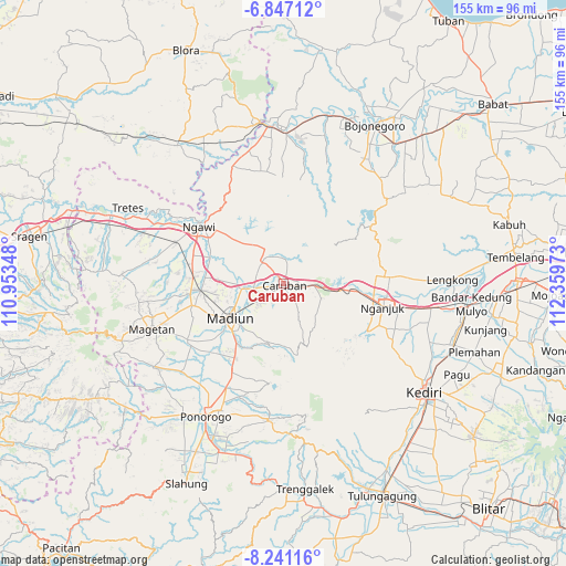
Caruban GPS coordinates[2]
7° 32' 40.92" South, 111° 39' 23.76" East
| Map corner | latitude | longitude |
|---|---|---|
| Upper-left | -6.84712°, | 110.95348° |
| Center: | -7.5447°, | 111.6566° |
| Lower-right: | -8.24116°, | 112.35973° |
| Map W x H: | 155×155 km | = 96.3×96.3mi |
| max Lat: | 5.88969° ⇑57% North |
| Caruban: | -7.5447° |
| min Lat: | ⇓43% South -10.934° |
| min Long | Caruban | max Long |
| 95.1345° | 111.6566° | 140.9419° |
| W 44.7%⇐ | ⇒55.3% E |
Elevation
Elevation of Caruban is 80 m = 262 ft, and this is 149.7 m = 491 ft below average elevation for this country.
| Max E: |
3185 m = 10449 ft | 55.7% |
| Avg. | 229.7 m = 754 ft | |
| Caruban | 80 m = 262 ft | |
Min E: |
-1 m = -3 ft | 44.3% |
See also: Indonesia elevation on elevation.city.
Geographical zone
Caruban is located in South Torrid zone (between Equator and Tropic of Capricorn). Distance of Equator is 838.9 km =521.3 mi to North.| Distance of | km | miles | from Caruban |
|---|---|---|---|
| Equator | 838.9 | 521.3 | to North |
| Tropic Capricorn | 1767 | 1098 | to South |
| Antarctic Circle | 6562.3 | 4077.6 | to South |
| South Pole | 9168.2 | 5696.9 | to South |


Nearby cities:
15 places around Caruban: (largest is in red/bold)
• Donan
37.7 km =23.4 mi,  356°
356°
• Klempun
36 km =22.4 mi,  347°
347°
• Madiun
17.4 km =10.8 mi,  237°
237°
• Mojorejo
37 km =23 mi,  336°
336°
• Mojosawit
33.6 km =20.9 mi,  10°
10°
• Nganjuk
28 km =17.4 mi,  103°
103°
• Ngawi
28 km =17.4 mi,  304°
304°
• Ngori
36.3 km =22.6 mi, 340°
• Ngrejeng
36.8 km =22.9 mi, 8°
• Pandan
35.4 km =22 mi, 343°
• Pelem
34.2 km =21.3 mi, 9°
• Pengkol
35.1 km =21.8 mi, 348°
• Tapelan
37.7 km =23.4 mi, 338°
• Tinumpuk
37.2 km =23.1 mi,  4°
4°
• Tlatah
37.3 km =23.2 mi, 7°
Sources, notices
• [Note1] Compared only with cities in Indonesia existing in our database
• [Src1] Map data: © OpenStreetMap contributors (CC-BY-SA)
• [Src2] Other city data from geonames.org with taken over terms of usage.
• [Src3] Geographical zone / Annual Mean Temperature by Robert A. Rohde @ Wikipedia
