Langgur geodata
Langgur (Maluku) is a seat of a second-order administrative division; located in Indonesia in Asia/Jayapura (GMT+9) time zone. In our database, there are 407 cities with bigger population. Compared to other cities in Indonesia, 88.1% of cities are located further ↓South; 99% of cities are located further ←West and 89% of cities have higher elevation than Langgur. Note1


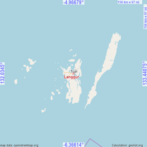
Langgur GPS coordinates[2]
5° 40' 0.804" South, 132° 44' 15.432" East
| Map corner | latitude | longitude |
|---|---|---|
| Upper-left | -4.96679°, | 132.0345° |
| Center: | -5.66689°, | 132.73762° |
| Lower-right: | -6.36614°, | 133.44075° |
| Map W x H: | 155.6×155.6 km | = 96.7×96.7mi |
| max Lat: | 5.88969° ⇑11.9% North |
| Langgur: | -5.66689° |
| min Lat: | ⇓88.1% South -10.934° |
| min Long | Langgur | max Long |
| 95.1345° | 132.73762° | 140.9419° |
| W 99%⇐ | ⇒1% E |
Elevation
Elevation of Langgur is 11 m = 36 ft, and this is 218.7 m = 718 ft below average elevation for this country.
| Max E: |
3185 m = 10449 ft | 89% |
| Avg. | 229.7 m = 754 ft | |
| Langgur | 11 m = 36 ft | |
Min E: |
-1 m = -3 ft | 11% |
See also: Indonesia elevation on elevation.city.
Geographical zone
Langgur is located in South Torrid zone (between Equator and Tropic of Capricorn). Distance of Equator is 630.1 km =391.5 mi to North.| Distance of | km | miles | from Langgur |
|---|---|---|---|
| Equator | 630.1 | 391.5 | to North |
| Tropic Capricorn | 1975.8 | 1227.7 | to South |
| Antarctic Circle | 6771.1 | 4207.4 | to South |
| South Pole | 9377 | 5826.6 | to South |


Nearby cities:
15 places around Langgur: (largest is in red/bold)
• Babo
356 km =221.2 mi,  12°
12°
• Bofuer
316.4 km =196.6 mi,  21°
21°
• Dobo
165.9 km =103.1 mi,  93°
93°
• Dulanpokpok
309 km =192 mi,  350°
350°
• Elat
25.8 km =16 mi, 87°
• Fakfak
308.8 km =191.9 mi, 350°
• Geser
283 km =175.8 mi,  314°
314°
• Kaimana
250.2 km =155.5 mi,  27°
27°
• Kiruru
313.2 km =194.6 mi,  52°
52°
• Kokas Kota
331.4 km =205.9 mi, 354°
• Kramongmongga
325.6 km =202.3 mi, 353°
• Onimsari
312.6 km =194.2 mi, 5°
• Patipi Pasir
335.4 km =208.4 mi, 348°
• Raduria
306.6 km =190.5 mi, 351°
• Tual
4.5 km =2.8 mi, 20°
Sources, notices
• [Note1] Compared only with cities in Indonesia existing in our database
• [Src1] Map data: © OpenStreetMap contributors (CC-BY-SA)
• [Src2] Other city data from geonames.org with taken over terms of usage.
• [Src3] Geographical zone / Annual Mean Temperature by Robert A. Rohde @ Wikipedia
