Geser geodata
Geser (Maluku) is a seat of a third-order administrative division; located in Indonesia in Asia/Jayapura (GMT+9) time zone. In our database, there are 407 cities with bigger population. Compared to other cities in Indonesia, 89.6% of cities are located further ↓South; 98.7% of cities are located further ←West and 71.2% of cities have higher elevation than Geser. Note1


Geser GPS coordinates[2]
3° 52' 23.52" South, 130° 55' 31.44" East
| Map corner | latitude | longitude |
|---|---|---|
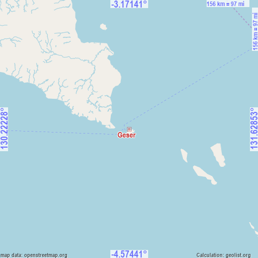
| Upper-left | -3.17141°, | 130.22228° |
| Center: | -3.8732°, | 130.9254° |
| Lower-right: | -4.57441°, | 131.62853° |
| Map W x H: | 156×156 km | = 96.9×96.9mi |
| max Lat: | 5.88969° ⇑10.4% North |
| Geser: | -3.8732° |
| min Lat: | ⇓89.6% South -10.934° |
| min Long | Geser | max Long |
| 95.1345° | 130.9254° | 140.9419° |
| W 98.7%⇐ | ⇒1.3% E |
Elevation
Elevation of Geser is 30 m = 98 ft, and this is 199.7 m = 655 ft below average elevation for this country.
| Max E: |
3185 m = 10449 ft | 71.2% |
| Avg. | 229.7 m = 754 ft | |
| Geser | 30 m = 98 ft | |
Min E: |
-1 m = -3 ft | 28.8% |
See also: Indonesia elevation on elevation.city.
Geographical zone
Geser is located in South Torrid zone (between Equator and Tropic of Capricorn). Distance of Equator is 430.7 km =267.6 mi to North.| Distance of | km | miles | from Geser |
|---|---|---|---|
| Equator | 430.7 | 267.6 | to North |
| Tropic Capricorn | 2175.3 | 1351.7 | to South |
| Antarctic Circle | 6970.5 | 4331.3 | to South |
| South Pole | 9576.4 | 5950.5 | to South |


Nearby cities:
15 places around Geser: (largest is in red/bold)
• Amahai
230.3 km =143.1 mi,  284°
284°
• Bula
97.2 km =60.4 mi,  330°
330°
• Dulanpokpok
182.8 km =113.6 mi,  54°
54°
• Fakfak
185.3 km =115.1 mi,  55°
55°
• Kokas Kota
212.6 km =132.1 mi, 52°
• Kramongmongga
203.5 km =126.4 mi, 52°
• Masohi
226.3 km =140.6 mi,  286°
286°
• Patipi Pasir
185.7 km =115.4 mi, 45°
• Raduria
187.8 km =116.7 mi, 56°
• Saparua
254.4 km =158.1 mi, 277°
• Serkos
238.3 km =148.1 mi,  35°
35°
• Tehoru
160.6 km =99.8 mi, 287°
• Wahai
195.1 km =121.2 mi,  307°
307°
• Waipia
237 km =147.3 mi, 288°
• Werinama
99.4 km =61.8 mi, 294°
Sources, notices
• [Note1] Compared only with cities in Indonesia existing in our database
• [Src1] Map data: © OpenStreetMap contributors (CC-BY-SA)
• [Src2] Other city data from geonames.org with taken over terms of usage.
• [Src3] Geographical zone / Annual Mean Temperature by Robert A. Rohde @ Wikipedia
