Jatibarang geodata
Jatibarang (West Java) is a populated place; located in Indonesia in Asia/Jakarta (GMT+7) time zone. With population of 73,010 people, there are 175 cities with bigger population in this country. Compared to other cities in Indonesia, 84.6% of cities are located further ↓South; 74.4% of cities are located further →East and 87.7% of cities have higher elevation than Jatibarang. Note1


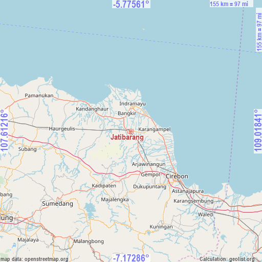
Jatibarang GPS coordinates[2]
6° 28' 28.992" South, 108° 18' 55.008" East
| Map corner | latitude | longitude |
|---|---|---|
| Upper-left | -5.77561°, | 107.61216° |
| Center: | -6.47472°, | 108.31528° |
| Lower-right: | -7.17286°, | 109.01841° |
| Map W x H: | 155.4×155.4 km | = 96.6×96.6mi |
| max Lat: | 5.88969° ⇑15.4% North |
| Jatibarang: | -6.47472° |
| min Lat: | ⇓84.6% South -10.934° |
| min Long | Jatibarang | max Long |
| 95.1345° | 108.31528° | 140.9419° |
| W 25.6%⇐ | ⇒74.4% E |
Elevation
Elevation of Jatibarang is 12 m = 39 ft, and this is 217.7 m = 714 ft below average elevation for this country.
| Max E: |
3185 m = 10449 ft | 87.7% |
| Avg. | 229.7 m = 754 ft | |
| Jatibarang | 12 m = 39 ft | |
Min E: |
-1 m = -3 ft | 12.3% |
See also: Jatibarang elevation on elevation.city.
Geographical zone
Jatibarang is located in South Torrid zone (between Equator and Tropic of Capricorn). Distance of Equator is 719.9 km =447.3 mi to North.| Distance of | km | miles | from Jatibarang |
|---|---|---|---|
| Equator | 719.9 | 447.3 | to North |
| Tropic Capricorn | 1886 | 1171.9 | to South |
| Antarctic Circle | 6681.3 | 4151.6 | to South |
| South Pole | 9287.1 | 5770.7 | to South |


Nearby cities:
15 places around Jatibarang: (largest is in red/bold)
• Arjawinangun
21.7 km =13.5 mi,  151°
151°
• Astanajapura
50.4 km =31.3 mi,  136°
136°
• Cirebon
37.1 km =23.1 mi,  133°
133°
• Indramayu
16.5 km =10.3 mi,  1°
1°
• Jatipamor
58.7 km =36.5 mi,  178°
178°
• Jatiwangi
29.4 km =18.3 mi,  191°
191°
• Karangampel
15.2 km =9.4 mi,  84°
84°
• Karangsembung
55.1 km =34.2 mi, 139°
• Klangenan
29.5 km =18.3 mi, 152°
• Kuningan
58.7 km =36.5 mi,  161°
161°
• Majalengka
41.3 km =25.7 mi, 193°
• Palimanan
28.5 km =17.7 mi, 155°
• Plumbon
31 km =19.3 mi, 145°
• Sumber
36.8 km =22.9 mi, 149°
• Weru
33.5 km =20.8 mi, 141°
Sources, notices
• [Note1] Compared only with cities in Indonesia existing in our database
• [Src1] Map data: © OpenStreetMap contributors (CC-BY-SA)
• [Src2] Other city data from geonames.org with taken over terms of usage.
• [Src3] Geographical zone / Annual Mean Temperature by Robert A. Rohde @ Wikipedia
