Donggala geodata
Donggala (Central Sulawesi) is a seat of a second-order administrative division; located in Indonesia in Asia/Makassar (GMT+8) time zone. In our database, there are 407 cities with bigger population. Compared to other cities in Indonesia, 94.3% of cities are located further ↓South; 82.2% of cities are located further ←West and 86.4% of cities have higher elevation than Donggala. Note1


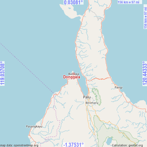
Donggala GPS coordinates[2]
0° 40' 20.28" South, 119° 44' 24.72" East
| Map corner | latitude | longitude |
|---|---|---|
| Upper-left | 0.03081°, | 119.03708° |
| Center: | -0.6723°, | 119.7402° |
| Lower-right: | -1.37531°, | 120.44333° |
| Map W x H: | 156.3×156.3 km | = 97.1×97.1mi |
| max Lat: | 5.88969° ⇑5.7% North |
| Donggala: | -0.6723° |
| min Lat: | ⇓94.3% South -10.934° |
| min Long | Donggala | max Long |
| 95.1345° | 119.7402° | 140.9419° |
| W 82.2%⇐ | ⇒17.8% E |
Elevation
Elevation of Donggala is 13 m = 43 ft, and this is 216.7 m = 711 ft below average elevation for this country.
| Max E: |
3185 m = 10449 ft | 86.4% |
| Avg. | 229.7 m = 754 ft | |
| Donggala | 13 m = 43 ft | |
Min E: |
-1 m = -3 ft | 13.6% |
See also: Indonesia elevation on elevation.city.
Geographical zone
Donggala is located in South Torrid zone (between Equator and Tropic of Capricorn). Distance of Equator is 74.8 km =46.5 mi to North.| Distance of | km | miles | from Donggala |
|---|---|---|---|
| Equator | 74.8 | 46.5 | to North |
| Tropic Capricorn | 2531.2 | 1572.8 | to South |
| Antarctic Circle | 7326.4 | 4552.4 | to South |
| South Pole | 9932.3 | 6171.6 | to South |


Nearby cities:
15 places around Donggala: (largest is in red/bold)
• Ampana
206.1 km =128.1 mi,  96°
96°
• Babana
167.5 km =104.1 mi,  201°
201°
• Kalumpang
202.8 km =126 mi,  188°
188°
• Kasiguncu
131.5 km =81.7 mi,  129°
129°
• Masamba
219.2 km =136.2 mi,  162°
162°
• Ogotua
190.6 km =118.4 mi,  17°
17°
• Palu
30 km =18.6 mi,  151°
151°
• Parigi
51.1 km =31.8 mi,  108°
108°
• Pendolo
188 km =116.8 mi, 146°
• Poso
138.3 km =85.9 mi, 125°
• Sigi Biromaru
36.6 km =22.7 mi, 147°
• Tagolu
143 km =88.9 mi, 126°
• Tentena
157.2 km =97.7 mi,  140°
140°
• Tinabogan
183.8 km =114.2 mi,  28°
28°
• Tobadak
163.5 km =101.6 mi, 195°
Sources, notices
• [Note1] Compared only with cities in Indonesia existing in our database
• [Src1] Map data: © OpenStreetMap contributors (CC-BY-SA)
• [Src2] Other city data from geonames.org with taken over terms of usage.
• [Src3] Geographical zone / Annual Mean Temperature by Robert A. Rohde @ Wikipedia
