Tentena geodata
Tentena (Central Sulawesi) is a seat of a third-order administrative division; located in Indonesia in Asia/Makassar (GMT+8) time zone. In our database, there are 407 cities with bigger population. Compared to other cities in Indonesia, 93.2% of cities are located further ↓South; 84.8% of cities are located further ←West and 85.2% of cities have lower elevation than Tentena. Note1


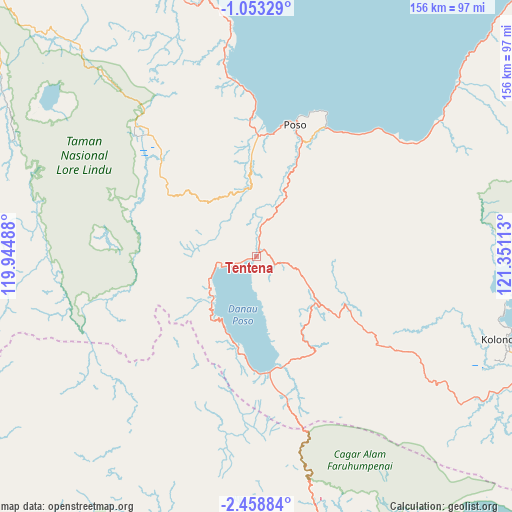
Tentena GPS coordinates[2]
1° 45' 22.32" South, 120° 38' 52.8" East
| Map corner | latitude | longitude |
|---|---|---|
| Upper-left | -1.05329°, | 119.94488° |
| Center: | -1.7562°, | 120.648° |
| Lower-right: | -2.45884°, | 121.35113° |
| Map W x H: | 156.3×156.3 km | = 97.1×97.1mi |
| max Lat: | 5.88969° ⇑6.8% North |
| Tentena: | -1.7562° |
| min Lat: | ⇓93.2% South -10.934° |
| min Long | Tentena | max Long |
| 95.1345° | 120.648° | 140.9419° |
| W 84.8%⇐ | ⇒15.2% E |
Elevation
Elevation of Tentena is 522 m = 1713 ft, and this is 292.3 m = 959 ft above average elevation for this country.
| Max E: |
3185 m = 10449 ft | 14.8% |
| Tentena | 522 m 1713 ft | |
| Avg. | 229.7 m = 754 ft | |
Min E: |
-1 m = -3 ft | 85.2% |
See also: Indonesia elevation on elevation.city.
Geographical zone
Tentena is located in South Torrid zone (between Equator and Tropic of Capricorn). Distance of Equator is 195.3 km =121.4 mi to North.| Distance of | km | miles | from Tentena |
|---|---|---|---|
| Equator | 195.3 | 121.4 | to North |
| Tropic Capricorn | 2410.6 | 1497.9 | to South |
| Antarctic Circle | 7205.9 | 4477.5 | to South |
| South Pole | 9811.8 | 6096.8 | to South |


Nearby cities:
15 places around Tentena: (largest is in red/bold)
• Bonebone
95 km =59 mi,  188°
188°
• Kasiguncu
37.3 km =23.2 mi,  1°
1°
• Kolonodale
80.5 km =50 mi,  108°
108°
• Malili
109.6 km =68.1 mi,  153°
153°
• Mangkutana
83.5 km =51.9 mi,  167°
167°
• Masamba
95.5 km =59.3 mi,  201°
201°
• Palu
127.9 km =79.5 mi,  317°
317°
• Parigi
117 km =72.7 mi,  333°
333°
• Pendolo
35.6 km =22.1 mi, 173°
• Poso
41.7 km =25.9 mi,  16°
16°
• Sigi Biromaru
120.9 km =75.1 mi, 317°
• Sukamaju
97 km =60.3 mi, 192°
• Tagolu
37.9 km =23.5 mi, 21°
• Wonorejo
84 km =52.2 mi, 167°
• Wotu
94.4 km =58.7 mi, 169°
Sources, notices
• [Note1] Compared only with cities in Indonesia existing in our database
• [Src1] Map data: © OpenStreetMap contributors (CC-BY-SA)
• [Src2] Other city data from geonames.org with taken over terms of usage.
• [Src3] Geographical zone / Annual Mean Temperature by Robert A. Rohde @ Wikipedia
