Cerenti geodata
Cerenti (Riau) is a seat of a third-order administrative division; located in Indonesia in Asia/Jakarta (GMT+7) time zone. In our database, there are 407 cities with bigger population. Compared to other cities in Indonesia, 94.6% of cities are located further ↓South; 96.2% of cities are located further →East and 65.6% of cities have higher elevation than Cerenti. Note1


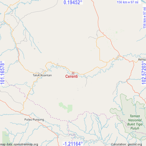
Cerenti GPS coordinates[2]
0° 30' 30.96" South, 101° 52' 8.04" East
| Map corner | latitude | longitude |
|---|---|---|
| Upper-left | 0.19452°, | 101.16578° |
| Center: | -0.5086°, | 101.8689° |
| Lower-right: | -1.21164°, | 102.57203° |
| Map W x H: | 156.4×156.4 km | = 97.2×97.2mi |
| max Lat: | 5.88969° ⇑5.4% North |
| Cerenti: | -0.5086° |
| min Lat: | ⇓94.6% South -10.934° |
| min Long | Cerenti | max Long |
| 95.1345° | 101.8689° | 140.9419° |
| W 3.8%⇐ | ⇒96.2% E |
Elevation
Elevation of Cerenti is 41 m = 135 ft, and this is 188.7 m = 619 ft below average elevation for this country.
| Max E: |
3185 m = 10449 ft | 65.6% |
| Avg. | 229.7 m = 754 ft | |
| Cerenti | 41 m = 135 ft | |
Min E: |
-1 m = -3 ft | 34.4% |
See also: Indonesia elevation on elevation.city.
Geographical zone
Cerenti is located in South Torrid zone (between Equator and Tropic of Capricorn). Distance of Equator is 56.6 km =35.2 mi to North.| Distance of | km | miles | from Cerenti |
|---|---|---|---|
| Equator | 56.6 | 35.2 | to North |
| Tropic Capricorn | 2549.4 | 1584.1 | to South |
| Antarctic Circle | 7344.6 | 4563.7 | to South |
| South Pole | 9950.5 | 6183 | to South |


Nearby cities:
15 places around Cerenti: (largest is in red/bold)
• Airmolek
49.5 km =30.8 mi,  71°
71°
• Baserah
15.6 km =9.7 mi,  296°
296°
• Kotabaru
67 km =41.6 mi,  190°
190°
• Lubukjambi
47.3 km =29.4 mi,  250°
250°
• Muaralembu
60.6 km =37.7 mi,  283°
283°
• Pangkalan Kasai
58.6 km =36.4 mi,  98°
98°
• Pangkalan Kerinci
100.6 km =62.5 mi,  359°
359°
• Pangkalanbunut
94.8 km =58.9 mi,  18°
18°
• Peranap
13.4 km =8.3 mi,  107°
107°
• Pulau Punjung
64.7 km =40.2 mi,  219°
219°
• Pulautemiang
89.8 km =55.8 mi,  152°
152°
• Rantauambacang
99 km =61.5 mi,  176°
176°
• Rengat
77 km =47.8 mi,  78°
78°
• Tanjunggadang
80.4 km =50 mi, 248°
• Teluk Kuantan
32.1 km =19.9 mi,  266°
266°
Sources, notices
• [Note1] Compared only with cities in Indonesia existing in our database
• [Src1] Map data: © OpenStreetMap contributors (CC-BY-SA)
• [Src2] Other city data from geonames.org with taken over terms of usage.
• [Src3] Geographical zone / Annual Mean Temperature by Robert A. Rohde @ Wikipedia
