Kotabaru geodata
Kotabaru (West Sumatra) is a seat of a third-order administrative division; located in Indonesia in Asia/Jakarta (GMT+7) time zone. In our database, there are 407 cities with bigger population. Compared to other cities in Indonesia, 93.8% of cities are located further ↓South; 96.2% of cities are located further →East and 55.1% of cities have higher elevation than Kotabaru. Note1


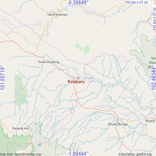
Kotabaru GPS coordinates[2]
1° 6' 5.58" South, 101° 45' 37.116" East
| Map corner | latitude | longitude |
|---|---|---|
| Upper-left | -0.39849°, | 101.05719° |
| Center: | -1.10155°, | 101.76031° |
| Lower-right: | -1.80444°, | 102.46344° |
| Map W x H: | 156.3×156.3 km | = 97.1×97.1mi |
| max Lat: | 5.88969° ⇑6.2% North |
| Kotabaru: | -1.10155° |
| min Lat: | ⇓93.8% South -10.934° |
| min Long | Kotabaru | max Long |
| 95.1345° | 101.76031° | 140.9419° |
| W 3.8%⇐ | ⇒96.2% E |
Elevation
Elevation of Kotabaru is 84 m = 276 ft, and this is 145.7 m = 478 ft below average elevation for this country.
| Max E: |
3185 m = 10449 ft | 55.1% |
| Avg. | 229.7 m = 754 ft | |
| Kotabaru | 84 m = 276 ft | |
Min E: |
-1 m = -3 ft | 44.9% |
See also: Indonesia elevation on elevation.city.
Geographical zone
Kotabaru is located in South Torrid zone (between Equator and Tropic of Capricorn). Distance of Equator is 122.5 km =76.1 mi to North.| Distance of | km | miles | from Kotabaru |
|---|---|---|---|
| Equator | 122.5 | 76.1 | to North |
| Tropic Capricorn | 2483.4 | 1543.1 | to South |
| Antarctic Circle | 7278.7 | 4522.8 | to South |
| South Pole | 9884.6 | 6142 | to South |


Nearby cities:
15 places around Kotabaru: (largest is in red/bold)
• Baserah
72.9 km =45.3 mi,  358°
358°
• Cerenti
67 km =41.6 mi,  10°
10°
• Lubukgadang
71.7 km =44.6 mi,  228°
228°
• Lubukjambi
59.6 km =37 mi,  326°
326°
• Muara Bungo
58.5 km =36.4 mi,  137°
137°
• Muara Tebo
86.6 km =53.8 mi,  118°
118°
• Muaralabuh
91.2 km =56.7 mi,  243°
243°
• Padang Aro
72.7 km =45.2 mi, 229°
• Pangkalan Kasai
90.3 km =56.1 mi,  50°
50°
• Peranap
66.7 km =41.4 mi,  21°
21°
• Pulau Punjung
33 km =20.5 mi,  298°
298°
• Pulautemiang
55.3 km =34.4 mi,  104°
104°
• Rantauambacang
37.4 km =23.2 mi,  151°
151°
• Tanjunggadang
72.1 km =44.8 mi, 299°
• Teluk Kuantan
66.8 km =41.5 mi,  342°
342°
Sources, notices
• [Note1] Compared only with cities in Indonesia existing in our database
• [Src1] Map data: © OpenStreetMap contributors (CC-BY-SA)
• [Src2] Other city data from geonames.org with taken over terms of usage.
• [Src3] Geographical zone / Annual Mean Temperature by Robert A. Rohde @ Wikipedia
