Baluk geodata
Baluk (East Nusa Tenggara) is a seat of a fourth-order administrative division; located in Indonesia in Asia/Makassar (GMT+8) time zone. In our database, there are 407 cities with bigger population. Compared to other cities in Indonesia, 90.3% of cities are located further ↑North; 88.8% of cities are located further ←West and 83% of cities have higher elevation than Baluk. Note1


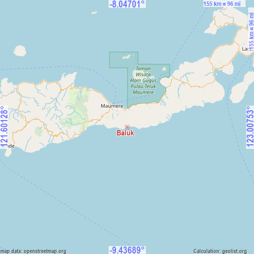
Baluk GPS coordinates[2]
8° 44' 33.36" South, 122° 18' 15.84" East
| Map corner | latitude | longitude |
|---|---|---|
| Upper-left | -8.04701°, | 121.60128° |
| Center: | -8.7426°, | 122.3044° |
| Lower-right: | -9.43689°, | 123.00753° |
| Map W x H: | 154.5×154.5 km | = 96×96mi |
| max Lat: | 5.88969° ⇑90.3% North |
| Baluk: | -8.7426° |
| min Lat: | ⇓9.7% South -10.934° |
| min Long | Baluk | max Long |
| 95.1345° | 122.3044° | 140.9419° |
| W 88.8%⇐ | ⇒11.2% E |
Elevation
Elevation of Baluk is 16 m = 52 ft, and this is 213.7 m = 701 ft below average elevation for this country.
| Max E: |
3185 m = 10449 ft | 83% |
| Avg. | 229.7 m = 754 ft | |
| Baluk | 16 m = 52 ft | |
Min E: |
-1 m = -3 ft | 17% |
See also: Indonesia elevation on elevation.city.
Geographical zone
Baluk is located in South Torrid zone (between Equator and Tropic of Capricorn). Distance of Equator is 972.1 km =604 mi to North.| Distance of | km | miles | from Baluk |
|---|---|---|---|
| Equator | 972.1 | 604 | to North |
| Tropic Capricorn | 1633.8 | 1015.2 | to South |
| Antarctic Circle | 6429.1 | 3994.9 | to South |
| South Pole | 9035 | 5614.1 | to South |


Nearby cities:
15 places around Baluk: (largest is in red/bold)
• Baobatun
6.7 km =4.2 mi,  337°
337°
• Bei
6 km =3.7 mi,  321°
321°
• Bola
0.9 km =0.6 mi,  274°
274°
• Habibola
7.3 km =4.5 mi,  95°
95°
• Habingkloang
8 km =5 mi,  308°
308°
• Hokor
6.7 km =4.2 mi,  277°
277°
• Ili
8.6 km =5.3 mi,  330°
330°
• Kloangpopot
6.3 km =3.9 mi,  56°
56°
• Kloangrotat
7.8 km =4.8 mi,  25°
25°
• Magetlegar
7.1 km =4.4 mi,  46°
46°
• Ojan
6.5 km =4 mi, 312°
• Potet
6.6 km =4.1 mi,  3°
3°
• Taranggatar
3.7 km =2.3 mi, 277°
• Watublapi
4.7 km =2.9 mi,  11°
11°
• Wolokoli
3.1 km =1.9 mi,  301°
301°
Sources, notices
• [Note1] Compared only with cities in Indonesia existing in our database
• [Src1] Map data: © OpenStreetMap contributors (CC-BY-SA)
• [Src2] Other city data from geonames.org with taken over terms of usage.
• [Src3] Geographical zone / Annual Mean Temperature by Robert A. Rohde @ Wikipedia
