Clifden geodata
Clifden (Connaught) is a populated place; located in Ireland in Europe/Dublin (GMT+1) time zone. With population of 2,056 people, there are 228 cities with bigger population in this country. Compared to other cities in Ireland, 71.3% of cities are located further ↓South; 99.2% of cities are located further →East and 71.9% of cities have higher elevation than Clifden. Note1


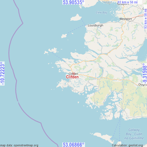
Clifden GPS coordinates[2]
53° 29' 20.652" North, 10° 1' 8.76" West
| Map corner | latitude | longitude |
|---|---|---|
| Upper-left | 53.90535°, | -10.72223° |
| Center: | 53.48907°, | -10.0191° |
| Lower-right: | 53.06866°, | -9.31598° |
| Map W x H: | 93×93 km | = 57.8×57.8mi |
| max Lat: | 55.25° ⇑28.7% North |
| Clifden: | 53.48907° |
| min Lat: | ⇓71.3% South 51.52487° |
| min Long | Clifden | max Long |
| -10.26889° | -10.0191° | -6.04944° |
| W 0.8%⇐ | ⇒99.2% E |
Elevation
Elevation of Clifden is 25 m = 82 ft, and this is 29.5 m = 97 ft below average elevation for this country.
| Max E: |
262 m = 860 ft | 71.9% |
| Avg. | 54.5 m = 179 ft | |
| Clifden | 25 m = 82 ft | |
Min E: |
0 m = 0 ft | 28.1% |
See also: Ireland elevation on elevation.city.
Geographical zone
Clifden is located in North temperate zone (between Tropic of Cancer and the Arctic Circle). Distance of this North polar circle is 1453.7 km =903.3 mi to North.| Distance of | km | miles | from Clifden |
|---|---|---|---|
| North Pole | 4059.6 | 2522.5 | to North |
| Arctic Circle | 1453.7 | 903.3 | to North |
| Tropic Cancer | 3341.5 | 2076.3 | to South |
| Equator | 5947.4 | 3695.5 | to South |


Nearby cities:
15 places around Clifden: (largest is in red/bold)
• Balla
68.3 km =42.4 mi,  59°
59°
• Ballinrobe
54.3 km =33.7 mi,  72°
72°
• Bearna
63.4 km =39.4 mi,  114°
114°
• Carraroe
37.5 km =23.3 mi,  131°
131°
• Castlebar
62.1 km =38.6 mi,  49°
49°
• Claregalway
73.1 km =45.4 mi,  103°
103°
• Claremorris
71.8 km =44.6 mi, 69°
• Dooagh
54.5 km =33.9 mi,  352°
352°
• Gaillimh
68.7 km =42.7 mi, 110°
• Headford
60.9 km =37.8 mi,  92°
92°
• Lisdoonvarna
70.3 km =43.7 mi,  136°
136°
• Moycullen
58.1 km =36.1 mi, 106°
• Newport
54 km =33.6 mi,  35°
35°
• Oughterard
46.1 km =28.6 mi, 100°
• Westport
47.9 km =29.8 mi, 43°
Sources, notices
• [Note1] Compared only with cities in Ireland existing in our database
• [Src1] Map data: © OpenStreetMap contributors (CC-BY-SA)
• [Src2] Other city data from geonames.org with taken over terms of usage.
• [Src3] Geographical zone / Annual Mean Temperature by Robert A. Rohde @ Wikipedia
