Charlestown geodata
Charlestown (Connaught) is a populated place; located in Ireland in Europe/Dublin (GMT+1) time zone. With population of 914 people, there are 365 cities with bigger population in this country. Compared to other cities in Ireland, 86.5% of cities are located further ↓South; 84.3% of cities are located further →East and 66% of cities have lower elevation than Charlestown. Note1


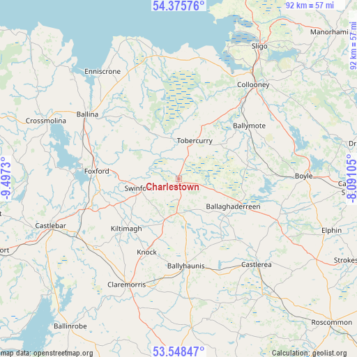
Charlestown GPS coordinates[2]
53° 57' 51.012" North, 8° 47' 39.012" West
| Map corner | latitude | longitude |
|---|---|---|
| Upper-left | 54.37576°, | -9.4973° |
| Center: | 53.96417°, | -8.79417° |
| Lower-right: | 53.54847°, | -8.09105° |
| Map W x H: | 92×92 km | = 57.2×57.2mi |
| max Lat: | 55.25° ⇑13.5% North |
| Charlestown: | 53.96417° |
| min Lat: | ⇓86.5% South 51.52487° |
| min Long | Charlestown | max Long |
| -10.26889° | -8.79417° | -6.04944° |
| W 15.7%⇐ | ⇒84.3% E |
Elevation
Elevation of Charlestown is 65 m = 213 ft, and this is 10.5 m = 34 ft above average elevation for this country.
| Max E: |
262 m = 860 ft | 34% |
| Charlestown | 65 m 213 ft | |
| Avg. | 54.5 m = 179 ft | |
Min E: |
0 m = 0 ft | 66% |
See also: Ireland elevation on elevation.city.
Geographical zone
Charlestown is located in North temperate zone (between Tropic of Cancer and the Arctic Circle). Distance of this North polar circle is 1400.9 km =870.5 mi to North.| Distance of | km | miles | from Charlestown |
|---|---|---|---|
| North Pole | 4006.8 | 2489.7 | to North |
| Arctic Circle | 1400.9 | 870.5 | to North |
| Tropic Cancer | 3394.3 | 2109.1 | to South |
| Equator | 6000.3 | 3728.4 | to South |


Nearby cities:
15 places around Charlestown: (largest is in red/bold)
• Balla
28.3 km =17.6 mi,  230°
230°
• Ballaghaderreen
15.5 km =9.6 mi,  117°
117°
• Ballina
29.6 km =18.4 mi,  304°
304°
• Ballyhaunis
22 km =13.7 mi,  175°
175°
• Ballymote
22.5 km =14 mi,  53°
53°
• Boyle
32.3 km =20.1 mi,  89°
89°
• Castlerea
29.2 km =18.1 mi,  138°
138°
• Claremorris
30.7 km =19.1 mi,  206°
206°
• Collooney
31 km =19.3 mi,  38°
38°
• Coolaney
27 km =16.8 mi,  28°
28°
• Foxford
21.1 km =13.1 mi,  274°
274°
• Kiltamagh
18.5 km =11.5 mi, 226°
• Knock
21 km =13 mi,  203°
203°
• Swinford
10.3 km =6.4 mi,  261°
261°
• Tobercurry
10.3 km =6.4 mi,  22°
22°
Sources, notices
• [Note1] Compared only with cities in Ireland existing in our database
• [Src1] Map data: © OpenStreetMap contributors (CC-BY-SA)
• [Src2] Other city data from geonames.org with taken over terms of usage.
• [Src3] Geographical zone / Annual Mean Temperature by Robert A. Rohde @ Wikipedia
