Carnew geodata
Carnew (Leinster) is a populated place; located in Ireland in Europe/Dublin (GMT+1) time zone. With population of 1,091 people, there are 332 cities with bigger population in this country. Compared to other cities in Ireland, 71.5% of cities are located further ↑North; 74.2% of cities are located further ←West and 88% of cities have lower elevation than Carnew. Note1


Carnew GPS coordinates[2]
52° 42' 29.016" North, 6° 29' 39.984" West
| Map corner | latitude | longitude |
|---|---|---|
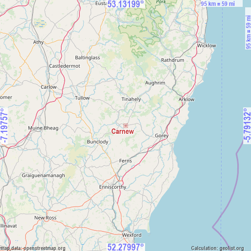
| Upper-left | 53.13199°, | -7.19757° |
| Center: | 52.70806°, | -6.49444° |
| Lower-right: | 52.27997°, | -5.79132° |
| Map W x H: | 94.7×94.7 km | = 58.8×58.8mi |
| max Lat: | 55.25° ⇑71.5% North |
| Carnew: | 52.70806° |
| min Lat: | ⇓28.5% South 51.52487° |
| min Long | Carnew | max Long |
| -10.26889° | -6.49444° | -6.04944° |
| W 74.2%⇐ | ⇒25.8% E |
Elevation
Elevation of Carnew is 101 m = 331 ft, and this is 46.5 m = 153 ft above average elevation for this country.
| Max E: |
262 m = 860 ft | 12% |
| Carnew | 101 m 331 ft | |
| Avg. | 54.5 m = 179 ft | |
Min E: |
0 m = 0 ft | 88% |
See also: Ireland elevation on elevation.city.
Geographical zone
Carnew is located in North temperate zone (between Tropic of Cancer and the Arctic Circle). Distance of this North polar circle is 1540.6 km =957.3 mi to North.| Distance of | km | miles | from Carnew |
|---|---|---|---|
| North Pole | 4146.5 | 2576.5 | to North |
| Arctic Circle | 1540.6 | 957.3 | to North |
| Tropic Cancer | 3254.7 | 2022.4 | to South |
| Equator | 5860.6 | 3641.6 | to South |


Nearby cities:
15 places around Carnew: (largest is in red/bold)
• Aughrim
19.7 km =12.2 mi,  34°
34°
• Ballinroad
22 km =13.7 mi,  164°
164°
• Ballon
18.8 km =11.7 mi,  281°
281°
• Ballycanew
17 km =10.6 mi,  130°
130°
• Bunclody
12.2 km =7.6 mi,  241°
241°
• Castletown
20.6 km =12.8 mi,  85°
85°
• Courtown
19.3 km =12 mi,  111°
111°
• Enniscorthy
23.4 km =14.5 mi,  190°
190°
• Ferns
13.3 km =8.3 mi,  181°
181°
• Gorey
14.1 km =8.8 mi, 105°
• Hacketstown
17.8 km =11.1 mi,  346°
346°
• Mucklagh
13.5 km =8.4 mi, 30°
• Rathvilly
23.2 km =14.4 mi,  324°
324°
• Tinahely
10.1 km =6.3 mi,  11°
11°
• Tullow
19.3 km =12 mi,  302°
302°
Sources, notices
• [Note1] Compared only with cities in Ireland existing in our database
• [Src1] Map data: © OpenStreetMap contributors (CC-BY-SA)
• [Src2] Other city data from geonames.org with taken over terms of usage.
• [Src3] Geographical zone / Annual Mean Temperature by Robert A. Rohde @ Wikipedia
