Knocknalower geodata
Knocknalower (Connaught) is a populated place; located in Ireland in Europe/Dublin (GMT+1) time zone. With population of 612 people, there are 477 cities with bigger population in this country. Compared to other cities in Ireland, 92.2% of cities are located further ↓South; 98.3% of cities are located further →East and 98.3% of cities have lower elevation than Knocknalower. Note1


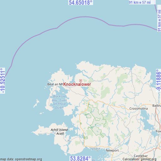
Knocknalower GPS coordinates[2]
54° 14' 28.824" North, 9° 49' 19.128" West
| Map corner | latitude | longitude |
|---|---|---|
| Upper-left | 54.65018°, | -10.52511° |
| Center: | 54.24134°, | -9.82198° |
| Lower-right: | 53.8284°, | -9.11886° |
| Map W x H: | 91.4×91.4 km | = 56.8×56.8mi |
| max Lat: | 55.25° ⇑7.8% North |
| Knocknalower: | 54.24134° |
| min Lat: | ⇓92.2% South 51.52487° |
| min Long | Knocknalower | max Long |
| -10.26889° | -9.82198° | -6.04944° |
| W 1.7%⇐ | ⇒98.3% E |
Elevation
Elevation of Knocknalower is 172 m = 564 ft, and this is 117.5 m = 385 ft above average elevation for this country.
| Max E: |
262 m = 860 ft | 1.7% |
| Knocknalower | 172 m 564 ft | |
| Avg. | 54.5 m = 179 ft | |
Min E: |
0 m = 0 ft | 98.3% |
See also: Ireland elevation on elevation.city.
Geographical zone
Knocknalower is located in North temperate zone (between Tropic of Cancer and the Arctic Circle). Distance of this North polar circle is 1370.1 km =851.3 mi to North.| Distance of | km | miles | from Knocknalower |
|---|---|---|---|
| North Pole | 3976 | 2470.6 | to North |
| Arctic Circle | 1370.1 | 851.3 | to North |
| Tropic Cancer | 3425.2 | 2128.3 | to South |
| Equator | 6031.1 | 3747.6 | to South |


Nearby cities:
15 places around Knocknalower: (largest is in red/bold)
• Balla
66.5 km =41.3 mi,  137°
137°
• Ballina
44.8 km =27.8 mi,  108°
108°
• Belmullet
11.1 km =6.9 mi,  260°
260°
• Castlebar
55.3 km =34.4 mi, 141°
• Charlestown
73.8 km =45.9 mi, 114°
• Crossmolina
36.5 km =22.7 mi,  115°
115°
• Dooagh
35.6 km =22.1 mi,  213°
213°
• Foxford
54.4 km =33.8 mi, 122°
• Inishcrone
47.5 km =29.5 mi,  93°
93°
• Killala
39.3 km =24.4 mi, 94°
• Kiltamagh
69.1 km =42.9 mi,  129°
129°
• Newport
43.5 km =27 mi,  155°
155°
• Swinford
65.4 km =40.6 mi, 119°
• Tobercurry
74 km =46 mi, 106°
• Westport
53 km =32.9 mi, 157°
Sources, notices
• [Note1] Compared only with cities in Ireland existing in our database
• [Src1] Map data: © OpenStreetMap contributors (CC-BY-SA)
• [Src2] Other city data from geonames.org with taken over terms of usage.
• [Src3] Geographical zone / Annual Mean Temperature by Robert A. Rohde @ Wikipedia
