Jhulasan geodata
Jhulasan (Gujarat) is a populated place; located in India in Asia/Kolkata (GMT+5.5) time zone. With population of 8,000 people, there are 3126 cities with bigger population in this country. Compared to other cities in India, 53.8% of cities are located further ↓South; 96.8% of cities are located further →East and 73.4% of cities have higher elevation than Jhulasan. Note1


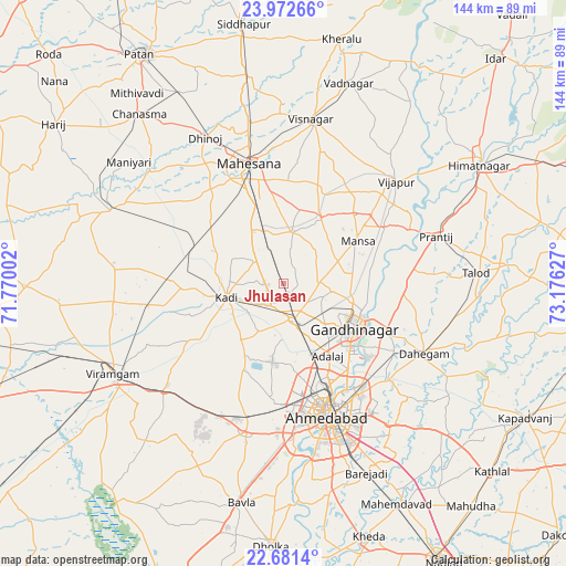
Jhulasan GPS coordinates[2]
23° 19' 42.96" North, 72° 28' 23.304" East
| Map corner | latitude | longitude |
|---|---|---|
| Upper-left | 23.97266°, | 71.77002° |
| Center: | 23.3286°, | 72.47314° |
| Lower-right: | 22.6814°, | 73.17627° |
| Map W x H: | 143.6×143.6 km | = 89.2×89.2mi |
| max Lat: | 34.9274° ⇑46.2% North |
| Jhulasan: | 23.3286° |
| min Lat: | ⇓53.8% South 8.09008° |
| min Long | Jhulasan | max Long |
| 68.82655° | 72.47314° | 96.81° |
| W 3.2%⇐ | ⇒96.8% E |
Elevation
Elevation of Jhulasan is 77 m = 253 ft, and this is 218.6 m = 717 ft below average elevation for this country.
| Max E: |
3681 m = 12077 ft | 73.4% |
| Avg. | 295.6 m = 970 ft | |
| Jhulasan | 77 m = 253 ft | |
Min E: |
1 m = 3 ft | 26.6% |
See also: India elevation on elevation.city.
Geographical zone
Jhulasan is located in North Torrid zone (between Equator and Tropic of Cancer). Distance of this Northern Tropic circle is 12 km =7.5 mi to North.| Distance of | km | miles | from Jhulasan |
|---|---|---|---|
| North Pole | 7413.2 | 4606.3 | to North |
| Arctic Circle | 4807.3 | 2987.1 | to North |
| Tropic Cancer | 12 | 7.5 | to North |
| Equator | 2593.9 | 1611.8 | to South |


Nearby cities:
15 places around Jhulasan: (largest is in red/bold)
• Adalaj
21.3 km =13.2 mi,  148°
148°
• Ahmedabad
35.6 km =22.1 mi,  160°
160°
• Chhala
30.8 km =19.1 mi,  94°
94°
• Chānasma
56.5 km =35.1 mi,  319°
319°
• Dahegām
39.8 km =24.7 mi,  116°
116°
• Gandhinagar
24.8 km =15.4 mi, 120°
• Kadi
14.6 km =9.1 mi,  257°
257°
• Mānsa
21.7 km =13.5 mi,  60°
60°
• Naroda
34.3 km =21.3 mi, 146°
• Sarkhej
38.5 km =23.9 mi,  175°
175°
• Sānand
38.5 km =23.9 mi,  194°
194°
• Unjha
53.5 km =33.2 mi,  350°
350°
• Vadnagar
53.6 km =33.3 mi,  18°
18°
• Vijāpur
38.3 km =23.8 mi,  47°
47°
• Visnagar
41.9 km =26 mi,  11°
11°
Sources, notices
• [Note1] Compared only with cities in India existing in our database
• [Src1] Map data: © OpenStreetMap contributors (CC-BY-SA)
• [Src2] Other city data from geonames.org with taken over terms of usage.
• [Src3] Geographical zone / Annual Mean Temperature by Robert A. Rohde @ Wikipedia
