Ampati geodata
Ampati (Meghalaya) is a seat of a second-order administrative division; located in India in Asia/Kolkata (GMT+5.5) time zone. In our database, there are 3475 cities with bigger population. Compared to other cities in India, 66.6% of cities are located further ↓South; 95.6% of cities are located further ←West and 85.1% of cities have higher elevation than Ampati. Note1


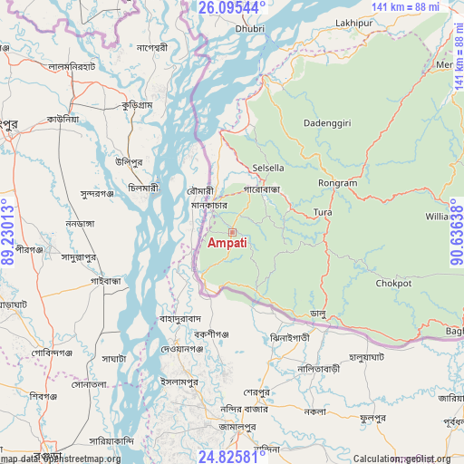
Ampati GPS coordinates[2]
25° 27' 44.28" North, 89° 55' 59.7" East
| Map corner | latitude | longitude |
|---|---|---|
| Upper-left | 26.09544°, | 89.23013° |
| Center: | 25.4623°, | 89.93325° |
| Lower-right: | 24.82581°, | 90.63638° |
| Map W x H: | 141.2×141.2 km | = 87.7×87.7mi |
| max Lat: | 34.9274° ⇑33.4% North |
| Ampati: | 25.4623° |
| min Lat: | ⇓66.6% South 8.09008° |
| min Long | Ampati | max Long |
| 68.82655° | 89.93325° | 96.81° |
| W 95.6%⇐ | ⇒4.4% E |
Elevation
Elevation of Ampati is 30 m = 98 ft, and this is 265.6 m = 871 ft below average elevation for this country.
| Max E: |
3681 m = 12077 ft | 85.1% |
| Avg. | 295.6 m = 970 ft | |
| Ampati | 30 m = 98 ft | |
Min E: |
1 m = 3 ft | 14.9% |
See also: India elevation on elevation.city.
Geographical zone
Ampati is located in North temperate zone (between Tropic of Cancer and the Arctic Circle). Distance of this Northern Tropic circle is 225.2 km =139.9 mi to South.| Distance of | km | miles | from Ampati |
|---|---|---|---|
| North Pole | 7175.9 | 4458.9 | to North |
| Arctic Circle | 4570 | 2839.7 | to North |
| Tropic Cancer | 225.2 | 139.9 | to South |
| Equator | 2831.1 | 1759.2 | to South |


Nearby cities:
15 places around Ampati: (largest is in red/bold)
• Bilāsipāra
90.8 km =56.4 mi,  19°
19°
• Chāpar
103.7 km =64.4 mi,  29°
29°
• Dhuburi
62.1 km =38.6 mi,  4°
4°
• Dīnhāta
88.5 km =55 mi,  327°
327°
• Gauripur
69.1 km =42.9 mi, 2°
• Golakganj
72 km =44.7 mi,  351°
351°
• Hatsingimari
27.7 km =17.2 mi, 353°
• Lakhipur
73.3 km =45.5 mi, 30°
• Latabāri
94 km =58.4 mi,  355°
355°
• Mankāchar
10.5 km =6.5 mi,  318°
318°
• Resubelpara
83.5 km =51.9 mi,  53°
53°
• Sapatgrām
99.1 km =61.6 mi,  11°
11°
• Tufānganj
98.7 km =61.3 mi,  344°
344°
• Tura
27.6 km =17.1 mi,  77°
77°
• Williamnagar
68.7 km =42.7 mi,  86°
86°
Sources, notices
• [Note1] Compared only with cities in India existing in our database
• [Src1] Map data: © OpenStreetMap contributors (CC-BY-SA)
• [Src2] Other city data from geonames.org with taken over terms of usage.
• [Src3] Geographical zone / Annual Mean Temperature by Robert A. Rohde @ Wikipedia
