Dīnhāta geodata
Dīnhāta (West Bengal) is a populated place; located in India in Asia/Kolkata (GMT+5.5) time zone. With population of 42,381 people, there are 1043 cities with bigger population in this country. Compared to other cities in India, 71.4% of cities are located further ↓South; 95.4% of cities are located further ←West and 81.7% of cities have higher elevation than Dīnhāta. Note1


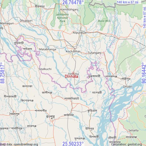
Dīnhāta GPS coordinates[2]
26° 8' 6.936" North, 89° 27' 40.644" East
| Map corner | latitude | longitude |
|---|---|---|
| Upper-left | 26.76478°, | 88.75817° |
| Center: | 26.13526°, | 89.46129° |
| Lower-right: | 25.50233°, | 90.16442° |
| Map W x H: | 140.4×140.4 km | = 87.2×87.2mi |
| max Lat: | 34.9274° ⇑28.6% North |
| Dīnhāta: | 26.13526° |
| min Lat: | ⇓71.4% South 8.09008° |
| min Long | Dīnhāta | max Long |
| 68.82655° | 89.46129° | 96.81° |
| W 95.4%⇐ | ⇒4.6% E |
Elevation
Elevation of Dīnhāta is 42 m = 138 ft, and this is 253.6 m = 832 ft below average elevation for this country.
| Max E: |
3681 m = 12077 ft | 81.7% |
| Avg. | 295.6 m = 970 ft | |
| Dīnhāta | 42 m = 138 ft | |
Min E: |
1 m = 3 ft | 18.3% |
See also: Dīnhāta elevation on elevation.city.
Geographical zone
Dīnhāta is located in North temperate zone (between Tropic of Cancer and the Arctic Circle). Distance of this Northern Tropic circle is 300 km =186.4 mi to South.| Distance of | km | miles | from Dīnhāta |
|---|---|---|---|
| North Pole | 7101.1 | 4412.4 | to North |
| Arctic Circle | 4495.2 | 2793.2 | to North |
| Tropic Cancer | 300 | 186.4 | to South |
| Equator | 2906 | 1805.7 | to South |


Nearby cities:
15 places around Dīnhāta: (largest is in red/bold)
• Alīpur Duār
39.2 km =24.4 mi,  9°
9°
• Birpara
70.6 km =43.9 mi,  333°
333°
• Dhuburi
54 km =33.6 mi,  103°
103°
• Dhupgāri
67.8 km =42.1 mi,  318°
318°
• Fālākāta
49.8 km =30.9 mi, 329°
• Gauripur
50.2 km =31.2 mi, 96°
• Golakganj
36.3 km =22.6 mi, 95°
• Goshaingaon
60.4 km =37.5 mi,  55°
55°
• Hatsingimari
64.6 km =40.1 mi,  137°
137°
• Hāsimāra
68.8 km =42.8 mi,  351°
351°
• Koch Bihār
21.2 km =13.2 mi,  355°
355°
• Latabāri
43.8 km =27.2 mi, 64°
• Mātābhānga
33.6 km =20.9 mi,  313°
313°
• Sapatgrām
69.8 km =43.4 mi,  71°
71°
• Tufānganj
28.7 km =17.8 mi,  45°
45°
Sources, notices
• [Note1] Compared only with cities in India existing in our database
• [Src1] Map data: © OpenStreetMap contributors (CC-BY-SA)
• [Src2] Other city data from geonames.org with taken over terms of usage.
• [Src3] Geographical zone / Annual Mean Temperature by Robert A. Rohde @ Wikipedia
