Udupi geodata
Udupi (Karnataka) is a populated place; located in India in Asia/Kolkata (GMT+5.5) time zone. With population of 165,000 people, there are 260 cities with bigger population in this country. Compared to other cities in India, 84.9% of cities are located further ↑North; 84.9% of cities are located further →East and 84.2% of cities have higher elevation than Udupi. Note1


Udupi GPS coordinates[2]
13° 20' 4.812" North, 74° 44' 46.212" East
| Map corner | latitude | longitude |
|---|---|---|
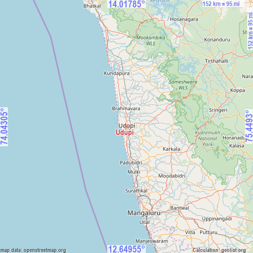
| Upper-left | 14.01785°, | 74.04305° |
| Center: | 13.33467°, | 74.74617° |
| Lower-right: | 12.64955°, | 75.4493° |
| Map W x H: | 152.1×152.1 km | = 94.5×94.5mi |
| max Lat: | 34.9274° ⇑84.9% North |
| Udupi: | 13.33467° |
| min Lat: | ⇓15.1% South 8.09008° |
| min Long | Udupi | max Long |
| 68.82655° | 74.74617° | 96.81° |
| W 15.1%⇐ | ⇒84.9% E |
Elevation
Elevation of Udupi is 33 m = 108 ft, and this is 262.6 m = 862 ft below average elevation for this country.
| Max E: |
3681 m = 12077 ft | 84.2% |
| Avg. | 295.6 m = 970 ft | |
| Udupi | 33 m = 108 ft | |
Min E: |
1 m = 3 ft | 15.8% |
See also: Udupi elevation on elevation.city.
Geographical zone
Udupi is located in North Torrid zone (between Equator and Tropic of Cancer). Distance of this Northern Tropic circle is 1123.2 km =697.9 mi to North.| Distance of | km | miles | from Udupi |
|---|---|---|---|
| North Pole | 8524.4 | 5296.8 | to North |
| Arctic Circle | 5918.5 | 3677.6 | to North |
| Tropic Cancer | 1123.2 | 697.9 | to North |
| Equator | 1482.7 | 921.3 | to South |


Nearby cities:
15 places around Udupi: (largest is in red/bold)
• Bantvāl
58.5 km =36.4 mi,  147°
147°
• Byndoor
60.4 km =37.5 mi,  348°
348°
• Coondapoor
33.5 km =20.8 mi, 349°
• Gangolli
36 km =22.4 mi, 346°
• Hosangadi
46.2 km =28.7 mi,  29°
29°
• Kārkala
29.8 km =18.5 mi,  116°
116°
• Malpe
4.9 km =3 mi,  289°
289°
• Mangalore
47.9 km =29.8 mi,  165°
165°
• Manipal
4.4 km =2.7 mi,  67°
67°
• Mūdbidri
40.2 km =25 mi,  137°
137°
• Mūlki
27.6 km =17.1 mi, 169°
• Pāngāla
9.4 km =5.8 mi,  177°
177°
• Someshwar
38.8 km =24.1 mi,  63°
63°
• Sringeri
55.6 km =34.5 mi,  80°
80°
• Ullal
60.1 km =37.3 mi, 168°
Sources, notices
• [Note1] Compared only with cities in India existing in our database
• [Src1] Map data: © OpenStreetMap contributors (CC-BY-SA)
• [Src2] Other city data from geonames.org with taken over terms of usage.
• [Src3] Geographical zone / Annual Mean Temperature by Robert A. Rohde @ Wikipedia
