Mūdbidri geodata
Mūdbidri (Karnataka) is a populated place; located in India in Asia/Kolkata (GMT+5.5) time zone. With population of 30,632 people, there are 1416 cities with bigger population in this country. Compared to other cities in India, 86.1% of cities are located further ↑North; 82.8% of cities are located further →East and 63.4% of cities have higher elevation than Mūdbidri. Note1


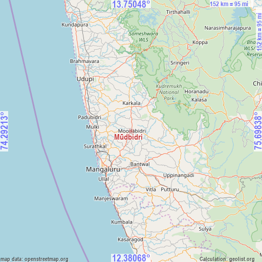
Mūdbidri GPS coordinates[2]
13° 3' 59.508" North, 74° 59' 42.9" East
| Map corner | latitude | longitude |
|---|---|---|
| Upper-left | 13.75048°, | 74.29213° |
| Center: | 13.06653°, | 74.99525° |
| Lower-right: | 12.38068°, | 75.69838° |
| Map W x H: | 152.3×152.3 km | = 94.6×94.6mi |
| max Lat: | 34.9274° ⇑86.1% North |
| Mūdbidri: | 13.06653° |
| min Lat: | ⇓13.9% South 8.09008° |
| min Long | Mūdbidri | max Long |
| 68.82655° | 74.99525° | 96.81° |
| W 17.2%⇐ | ⇒82.8% E |
Elevation
Elevation of Mūdbidri is 130 m = 427 ft, and this is 165.6 m = 543 ft below average elevation for this country.
| Max E: |
3681 m = 12077 ft | 63.4% |
| Avg. | 295.6 m = 970 ft | |
| Mūdbidri | 130 m = 427 ft | |
Min E: |
1 m = 3 ft | 36.6% |
See also: India elevation on elevation.city.
Geographical zone
Mūdbidri is located in North Torrid zone (between Equator and Tropic of Cancer). Distance of this Northern Tropic circle is 1153.1 km =716.5 mi to North.| Distance of | km | miles | from Mūdbidri |
|---|---|---|---|
| North Pole | 8554.2 | 5315.3 | to North |
| Arctic Circle | 5948.3 | 3696.1 | to North |
| Tropic Cancer | 1153.1 | 716.5 | to North |
| Equator | 1452.9 | 902.8 | to South |


Nearby cities:
15 places around Mūdbidri: (largest is in red/bold)
• Bantvāl
20 km =12.4 mi,  167°
167°
• Koppa
65.2 km =40.5 mi,  37°
37°
• Kārkala
16.4 km =10.2 mi,  358°
358°
• Kāsaragod
63.2 km =39.3 mi,  180°
180°
• Malpe
44.6 km =27.7 mi,  314°
314°
• Mangalore
22.4 km =13.9 mi,  222°
222°
• Manipal
39 km =24.2 mi,  323°
323°
• Manjēshvar
41 km =25.5 mi,  196°
196°
• Mūlki
22 km =13.7 mi,  277°
277°
• Puttūr
40.8 km =25.4 mi,  146°
146°
• Pāngāla
33.5 km =20.8 mi, 307°
• Someshwar
47.8 km =29.7 mi,  9°
9°
• Sringeri
47.9 km =29.8 mi, 35°
• Udupi
40.2 km =25 mi, 317°
• Ullal
32.5 km =20.2 mi,  206°
206°
Sources, notices
• [Note1] Compared only with cities in India existing in our database
• [Src1] Map data: © OpenStreetMap contributors (CC-BY-SA)
• [Src2] Other city data from geonames.org with taken over terms of usage.
• [Src3] Geographical zone / Annual Mean Temperature by Robert A. Rohde @ Wikipedia
