Sringeri geodata
Sringeri (Karnataka) is a populated place; located in India in Asia/Kolkata (GMT+5.5) time zone. With population of 4,271 people, there are 3368 cities with bigger population in this country. Compared to other cities in India, 84.5% of cities are located further ↑North; 80.5% of cities are located further →East and 90.5% of cities have lower elevation than Sringeri. Note1


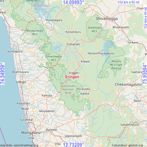
Sringeri GPS coordinates[2]
13° 25' 1.128" North, 75° 15' 9.756" East
| Map corner | latitude | longitude |
|---|---|---|
| Upper-left | 14.09993°, | 74.54959° |
| Center: | 13.41698°, | 75.25271° |
| Lower-right: | 12.73209°, | 75.95584° |
| Map W x H: | 152.1×152.1 km | = 94.5×94.5mi |
| max Lat: | 34.9274° ⇑84.5% North |
| Sringeri: | 13.41698° |
| min Lat: | ⇓15.5% South 8.09008° |
| min Long | Sringeri | max Long |
| 68.82655° | 75.25271° | 96.81° |
| W 19.5%⇐ | ⇒80.5% E |
Elevation
Elevation of Sringeri is 644 m = 2113 ft, and this is 348.4 m = 1143 ft above average elevation for this country.
| Max E: |
3681 m = 12077 ft | 9.5% |
| Sringeri | 644 m 2113 ft | |
| Avg. | 295.6 m = 970 ft | |
Min E: |
1 m = 3 ft | 90.5% |
See also: India elevation on elevation.city.
Geographical zone
Sringeri is located in North Torrid zone (between Equator and Tropic of Cancer). Distance of this Northern Tropic circle is 1114.1 km =692.3 mi to North.| Distance of | km | miles | from Sringeri |
|---|---|---|---|
| North Pole | 8515.2 | 5291.1 | to North |
| Arctic Circle | 5909.3 | 3671.9 | to North |
| Tropic Cancer | 1114.1 | 692.3 | to North |
| Equator | 1491.8 | 927 | to South |


Nearby cities:
15 places around Sringeri: (largest is in red/bold)
• Chikmagalūr
57.4 km =35.7 mi,  100°
100°
• Hosanagara
58.9 km =36.6 mi,  339°
339°
• Hosangadi
44.9 km =27.9 mi,  314°
314°
• Koppa
17.4 km =10.8 mi,  43°
43°
• Kārkala
36.1 km =22.4 mi,  231°
231°
• Malpe
59.8 km =37.2 mi,  262°
262°
• Manipal
51.3 km =31.9 mi, 261°
• Mudgere
52.6 km =32.7 mi,  126°
126°
• Mūdbidri
47.9 km =29.8 mi,  215°
215°
• Mūlki
61.5 km =38.2 mi, 233°
• Narasimharājapura
35.4 km =22 mi,  52°
52°
• Pāngāla
57.5 km =35.7 mi,  251°
251°
• Someshwar
21.8 km =13.5 mi,  292°
292°
• Tīrthahalli
30.2 km =18.8 mi,  358°
358°
• Udupi
55.6 km =34.5 mi, 260°
In other languages:
- In Spanish: Shringeri
- In France: Shringeri
- In Russian: Шрингери
- In Chinese: 斯林格埃里
Sources, notices
• [Note1] Compared only with cities in India existing in our database
• [Src1] Map data: © OpenStreetMap contributors (CC-BY-SA)
• [Src2] Other city data from geonames.org with taken over terms of usage.
• [Src3] Geographical zone / Annual Mean Temperature by Robert A. Rohde @ Wikipedia
