Puliyūr geodata
Puliyūr (Tamil Nadu) is a populated place; located in India in Asia/Kolkata (GMT+5.5) time zone. With population of 11,174 people, there are 2817 cities with bigger population in this country. Compared to other cities in India, 94.6% of cities are located further ↑North; 57.5% of cities are located further ←West and 66% of cities have higher elevation than Puliyūr. Note1


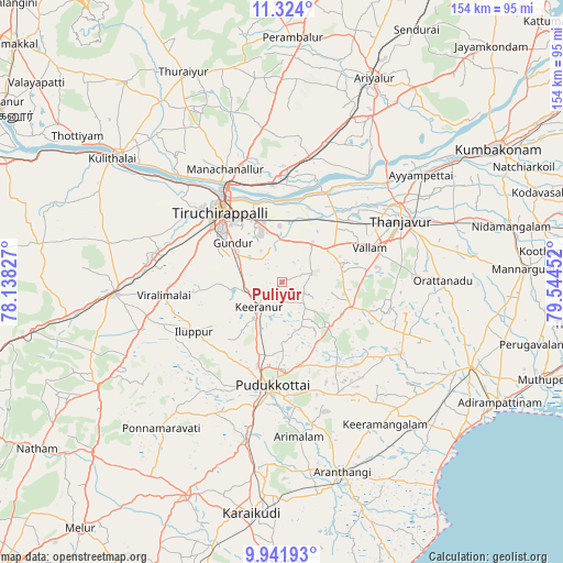
Puliyūr GPS coordinates[2]
10° 38' 1.5" North, 78° 50' 29.004" East
| Map corner | latitude | longitude |
|---|---|---|
| Upper-left | 11.324°, | 78.13827° |
| Center: | 10.63375°, | 78.84139° |
| Lower-right: | 9.94193°, | 79.54452° |
| Map W x H: | 153.7×153.7 km | = 95.5×95.5mi |
| max Lat: | 34.9274° ⇑94.6% North |
| Puliyūr: | 10.63375° |
| min Lat: | ⇓5.4% South 8.09008° |
| min Long | Puliyūr | max Long |
| 68.82655° | 78.84139° | 96.81° |
| W 57.5%⇐ | ⇒42.5% E |
Elevation
Elevation of Puliyūr is 113 m = 371 ft, and this is 182.6 m = 599 ft below average elevation for this country.
| Max E: |
3681 m = 12077 ft | 66% |
| Avg. | 295.6 m = 970 ft | |
| Puliyūr | 113 m = 371 ft | |
Min E: |
1 m = 3 ft | 34% |
See also: India elevation on elevation.city.
Geographical zone
Puliyūr is located in North Torrid zone (between Equator and Tropic of Cancer). Distance of Equator is 1182.4 km =734.7 mi to South.| Distance of | km | miles | from Puliyūr |
|---|---|---|---|
| North Pole | 8824.7 | 5483.4 | to North |
| Arctic Circle | 6218.8 | 3864.2 | to North |
| Tropic Cancer | 1423.6 | 884.6 | to North |
| Equator | 1182.4 | 734.7 | to South |


Nearby cities:
15 places around Puliyūr: (largest is in red/bold)
• Annavāsal
24.7 km =15.3 mi,  218°
218°
• Arimalam
42.4 km =26.3 mi,  173°
173°
• Iluppūr
27.3 km =17 mi,  240°
240°
• Karambakkudi
38.1 km =23.7 mi,  120°
120°
• Kīranūr
9.3 km =5.8 mi, 220°
• Lalgudi
26.8 km =16.7 mi,  354°
354°
• Manapparai
45.5 km =28.3 mi,  266°
266°
• Pudukkottai
28.2 km =17.5 mi,  184°
184°
• Pullambādi
35 km =21.7 mi,  12°
12°
• Tanjore
36.6 km =22.7 mi,  62°
62°
• Thirukattupalli
26.6 km =16.5 mi,  28°
28°
• Thiruvaiyaru
39.9 km =24.8 mi,  45°
45°
• Tiruchirappalli
25.7 km =16 mi,  321°
321°
• Vallam
25.7 km =16 mi,  68°
68°
• Ālangudi
34.2 km =21.3 mi,  152°
152°
Sources, notices
• [Note1] Compared only with cities in India existing in our database
• [Src1] Map data: © OpenStreetMap contributors (CC-BY-SA)
• [Src2] Other city data from geonames.org with taken over terms of usage.
• [Src3] Geographical zone / Annual Mean Temperature by Robert A. Rohde @ Wikipedia
