Madhogarh geodata
Madhogarh (Madhya Pradesh) is a populated place; located in India in Asia/Kolkata (GMT+5.5) time zone. With population of 5,051 people, there are 3341 cities with bigger population in this country. Compared to other cities in India, 61% of cities are located further ↓South; 72.6% of cities are located further ←West and 67.1% of cities have lower elevation than Madhogarh. Note1


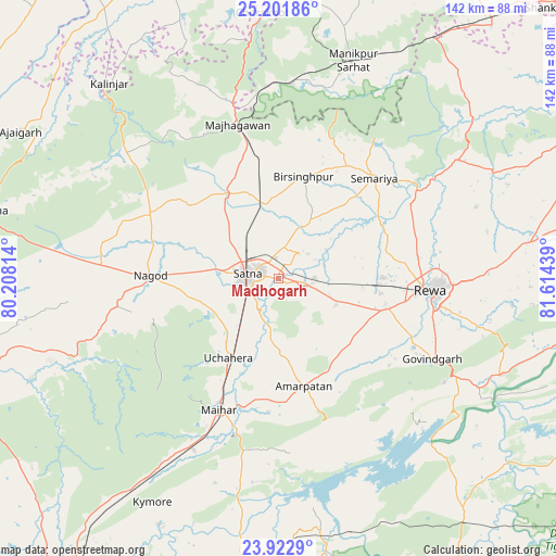
Madhogarh GPS coordinates[2]
24° 33' 50.436" North, 80° 54' 40.536" East
| Map corner | latitude | longitude |
|---|---|---|
| Upper-left | 25.20186°, | 80.20814° |
| Center: | 24.56401°, | 80.91126° |
| Lower-right: | 23.9229°, | 81.61439° |
| Map W x H: | 142.2×142.2 km | = 88.4×88.4mi |
| max Lat: | 34.9274° ⇑39% North |
| Madhogarh: | 24.56401° |
| min Lat: | ⇓61% South 8.09008° |
| min Long | Madhogarh | max Long |
| 68.82655° | 80.91126° | 96.81° |
| W 72.6%⇐ | ⇒27.4% E |
Elevation
Elevation of Madhogarh is 302 m = 991 ft, and this is 6.4 m = 21 ft above average elevation for this country.
| Max E: |
3681 m = 12077 ft | 32.9% |
| Madhogarh | 302 m 991 ft | |
| Avg. | 295.6 m = 970 ft | |
Min E: |
1 m = 3 ft | 67.1% |
See also: India elevation on elevation.city.
Geographical zone
Madhogarh is located in North temperate zone (between Tropic of Cancer and the Arctic Circle). Distance of this Northern Tropic circle is 125.3 km =77.9 mi to South.| Distance of | km | miles | from Madhogarh |
|---|---|---|---|
| North Pole | 7275.8 | 4521 | to North |
| Arctic Circle | 4669.9 | 2901.7 | to North |
| Tropic Cancer | 125.3 | 77.9 | to South |
| Equator | 2731.3 | 1697.2 | to South |


Nearby cities:
15 places around Madhogarh: (largest is in red/bold)
• Amarpātan
28.6 km =17.8 mi,  166°
166°
• Baikunthpur
53.6 km =33.3 mi,  70°
70°
• Govindgarh
44.1 km =27.4 mi,  117°
117°
• Gurh
60 km =37.3 mi,  96°
96°
• Kothi
24.9 km =15.5 mi,  327°
327°
• Kotwa
66.2 km =41.1 mi,  38°
38°
• Kotār
16.5 km =10.3 mi,  25°
25°
• Maihar
36.5 km =22.7 mi,  204°
204°
• Mangawān
65.2 km =40.5 mi,  79°
79°
• Mānikpur
58.4 km =36.3 mi,  18°
18°
• Nāgod
32.7 km =20.3 mi,  271°
271°
• Rewa
38.7 km =24 mi, 95°
• Satna
8.6 km =5.3 mi,  279°
279°
• Simaria
35.4 km =22 mi, 43°
• Sirmaur
54.9 km =34.1 mi,  56°
56°
Sources, notices
• [Note1] Compared only with cities in India existing in our database
• [Src1] Map data: © OpenStreetMap contributors (CC-BY-SA)
• [Src2] Other city data from geonames.org with taken over terms of usage.
• [Src3] Geographical zone / Annual Mean Temperature by Robert A. Rohde @ Wikipedia
