Mānikpur geodata
Mānikpur (Uttar Pradesh) is a populated place; located in India in Asia/Kolkata (GMT+5.5) time zone. With population of 14,415 people, there are 2519 cities with bigger population in this country. Compared to other cities in India, 63.8% of cities are located further ↓South; 73.2% of cities are located further ←West and 58.6% of cities have lower elevation than Mānikpur. Note1


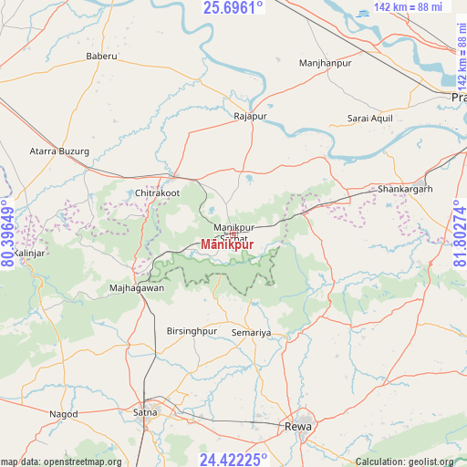
Mānikpur GPS coordinates[2]
25° 3' 38.988" North, 81° 5' 58.596" East
| Map corner | latitude | longitude |
|---|---|---|
| Upper-left | 25.6961°, | 80.39649° |
| Center: | 25.06083°, | 81.09961° |
| Lower-right: | 24.42225°, | 81.80274° |
| Map W x H: | 141.6×141.6 km | = 88×88mi |
| max Lat: | 34.9274° ⇑36.2% North |
| Mānikpur: | 25.06083° |
| min Lat: | ⇓63.8% South 8.09008° |
| min Long | Mānikpur | max Long |
| 68.82655° | 81.09961° | 96.81° |
| W 73.2%⇐ | ⇒26.8% E |
Elevation
Elevation of Mānikpur is 243 m = 797 ft, and this is 52.6 m = 173 ft below average elevation for this country.
| Max E: |
3681 m = 12077 ft | 41.4% |
| Avg. | 295.6 m = 970 ft | |
| Mānikpur | 243 m = 797 ft | |
Min E: |
1 m = 3 ft | 58.6% |
See also: India elevation on elevation.city.
Geographical zone
Mānikpur is located in North temperate zone (between Tropic of Cancer and the Arctic Circle). Distance of this Northern Tropic circle is 180.6 km =112.2 mi to South.| Distance of | km | miles | from Mānikpur |
|---|---|---|---|
| North Pole | 7220.6 | 4486.7 | to North |
| Arctic Circle | 4614.7 | 2867.4 | to North |
| Tropic Cancer | 180.6 | 112.2 | to South |
| Equator | 2786.5 | 1731.5 | to South |


Nearby cities:
15 places around Mānikpur: (largest is in red/bold)
• Atarra
58.7 km =36.5 mi,  295°
295°
• Baikunthpur
48.5 km =30.1 mi,  139°
139°
• Karārī
54.6 km =33.9 mi,  37°
37°
• Kothi
47.2 km =29.3 mi,  223°
223°
• Kotwa
22.4 km =13.9 mi,  98°
98°
• Kotār
42.1 km =26.2 mi,  196°
196°
• Madhogarh
58.4 km =36.3 mi, 198°
• Manjhanpur
59.1 km =36.7 mi,  27°
27°
• Oran
49.6 km =30.8 mi,  313°
313°
• Rājāpur
36.7 km =22.8 mi,  8°
8°
• Sarāi Ākil
54.4 km =33.8 mi,  49°
49°
• Shankargarh
53.9 km =33.5 mi,  75°
75°
• Simaria
30 km =18.6 mi,  169°
169°
• Sirmaur
36.5 km =22.7 mi,  133°
133°
• Teonthar
55.3 km =34.4 mi, 99°
Sources, notices
• [Note1] Compared only with cities in India existing in our database
• [Src1] Map data: © OpenStreetMap contributors (CC-BY-SA)
• [Src2] Other city data from geonames.org with taken over terms of usage.
• [Src3] Geographical zone / Annual Mean Temperature by Robert A. Rohde @ Wikipedia
