Gumia geodata
Gumia (Jharkhand) is a populated place; located in India in Asia/Kolkata (GMT+5.5) time zone. With population of 47,121 people, there are 937 cities with bigger population in this country. Compared to other cities in India, 56.8% of cities are located further ↓South; 86.4% of cities are located further ←West and 65.4% of cities have lower elevation than Gumia. Note1


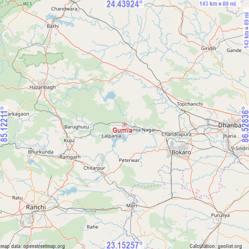
Gumia GPS coordinates[2]
23° 47' 51" North, 85° 49' 30.828" East
| Map corner | latitude | longitude |
|---|---|---|
| Upper-left | 24.43924°, | 85.12211° |
| Center: | 23.7975°, | 85.82523° |
| Lower-right: | 23.15257°, | 86.52836° |
| Map W x H: | 143.1×143.1 km | = 88.9×88.9mi |
| max Lat: | 34.9274° ⇑43.2% North |
| Gumia: | 23.7975° |
| min Lat: | ⇓56.8% South 8.09008° |
| min Long | Gumia | max Long |
| 68.82655° | 85.82523° | 96.81° |
| W 86.4%⇐ | ⇒13.6% E |
Elevation
Elevation of Gumia is 289 m = 948 ft, and this is 6.6 m = 22 ft below average elevation for this country.
| Max E: |
3681 m = 12077 ft | 34.6% |
| Avg. | 295.6 m = 970 ft | |
| Gumia | 289 m = 948 ft | |
Min E: |
1 m = 3 ft | 65.4% |
See also: Gumia elevation on elevation.city.
Geographical zone
Gumia is located in North temperate zone (between Tropic of Cancer and the Arctic Circle). Distance of this Northern Tropic circle is 40.1 km =24.9 mi to South.| Distance of | km | miles | from Gumia |
|---|---|---|---|
| North Pole | 7361 | 4573.9 | to North |
| Arctic Circle | 4755.1 | 2954.7 | to North |
| Tropic Cancer | 40.1 | 24.9 | to South |
| Equator | 2646 | 1644.1 | to South |


Nearby cities:
15 places around Gumia: (largest is in red/bold)
• Barki Saria
42.6 km =26.5 mi,  8°
8°
• Barkā Kānā
41.4 km =25.7 mi,  241°
241°
• Bokāro
13.4 km =8.3 mi,  94°
94°
• Chās
39.2 km =24.4 mi,  117°
117°
• Dugda
35.7 km =22.2 mi,  99°
99°
• Gomoh
34.3 km =21.3 mi,  75°
75°
• Hesla
30 km =18.6 mi, 10°
• Jhalidā
50.4 km =31.3 mi,  162°
162°
• Kuju
33 km =20.5 mi,  255°
255°
• Kātrās
48.1 km =29.9 mi, 89°
• Malkera
47.1 km =29.3 mi, 92°
• Muri
47.6 km =29.6 mi,  175°
175°
• Rāmgarh
36.1 km =22.4 mi, 238°
• Sāruberā
17.6 km =10.9 mi, 82°
• Topchānchi
39.7 km =24.7 mi,  72°
72°
Sources, notices
• [Note1] Compared only with cities in India existing in our database
• [Src1] Map data: © OpenStreetMap contributors (CC-BY-SA)
• [Src2] Other city data from geonames.org with taken over terms of usage.
• [Src3] Geographical zone / Annual Mean Temperature by Robert A. Rohde @ Wikipedia
